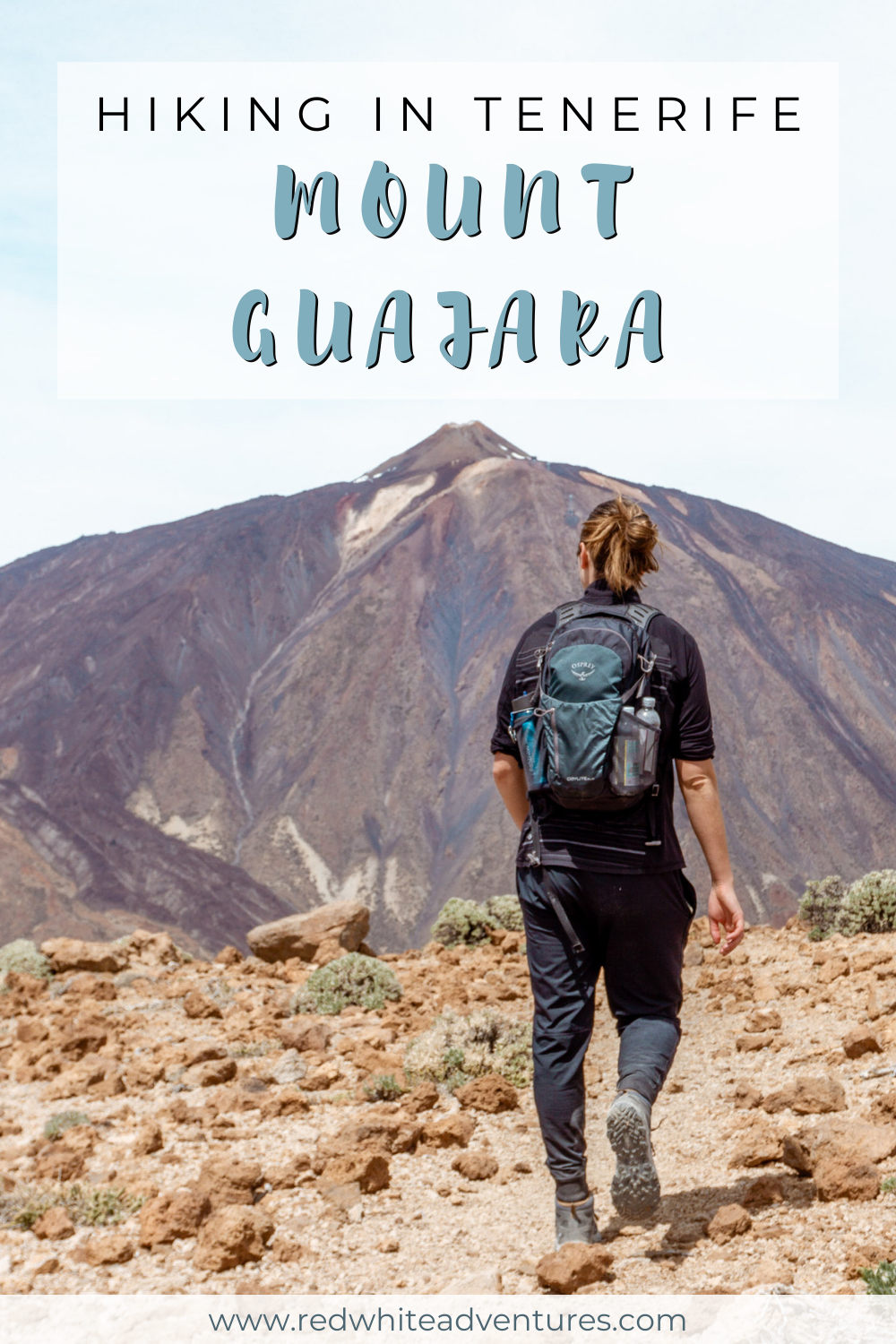
The Best View of Mount Teide – Mount Guajara Hike
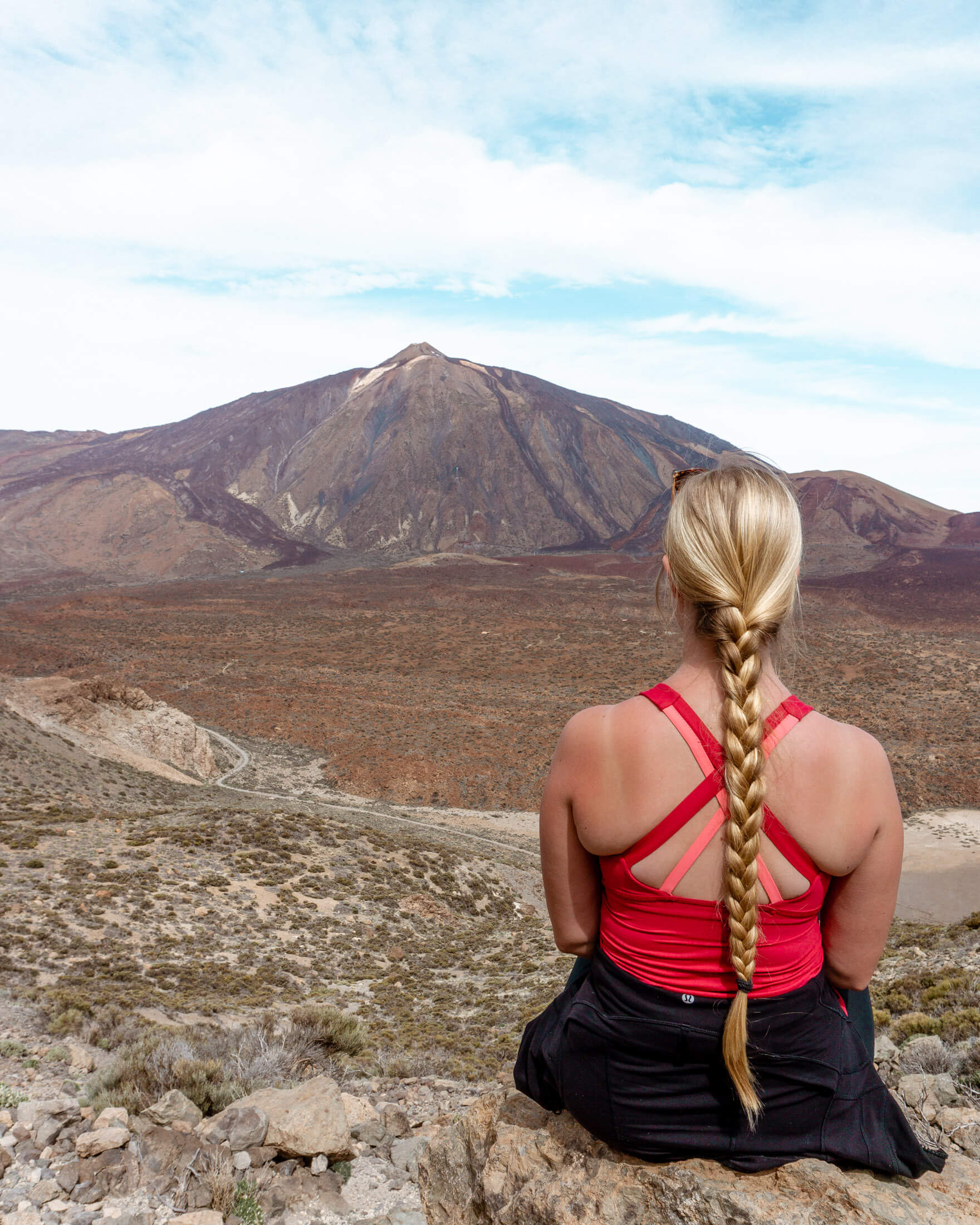
If you’re looking for the best view of El Teide without actually hiking up it, then the Mount Guajara summit hike is where you’ll get the best view of Teide.
On a clear day, it feels like you’re able to see the whole island from the top of Guajara which is located in the centre of the island only a short drive away from Teide.
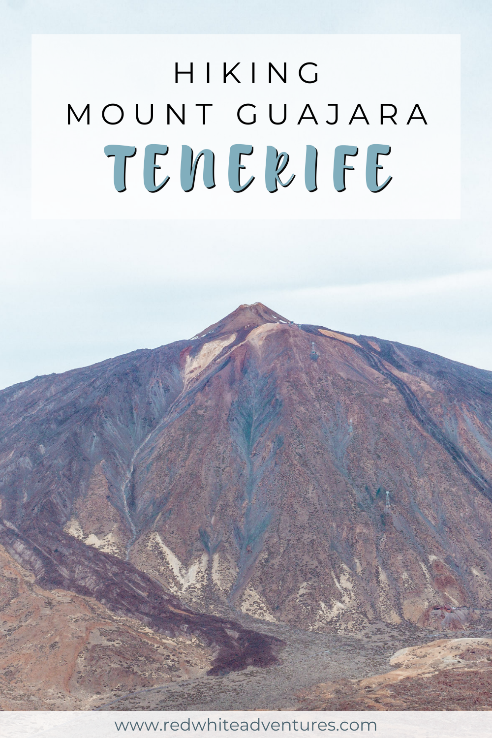
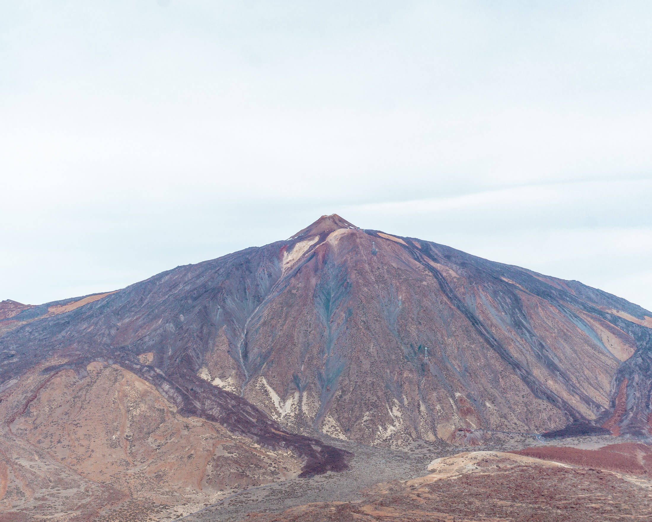
The summit of Mount Guajara is roughly 1000 meters lower than El Teide but it gives you the best view of the famous volcano!
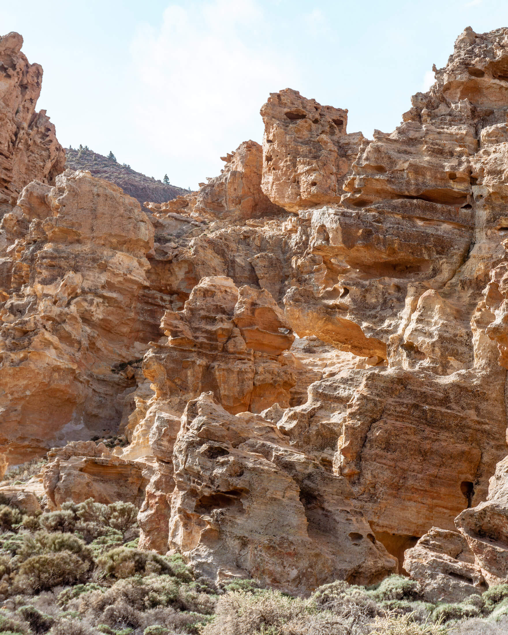
You will basically feel like you’re on Mars with the reddish/brown rock field down below that was caused by the eruption of Teide many moons ago.
It’s surreal because you truly think you’re on a different planet. It’s wild!
Everything you need to know about the Mount Guajara hike
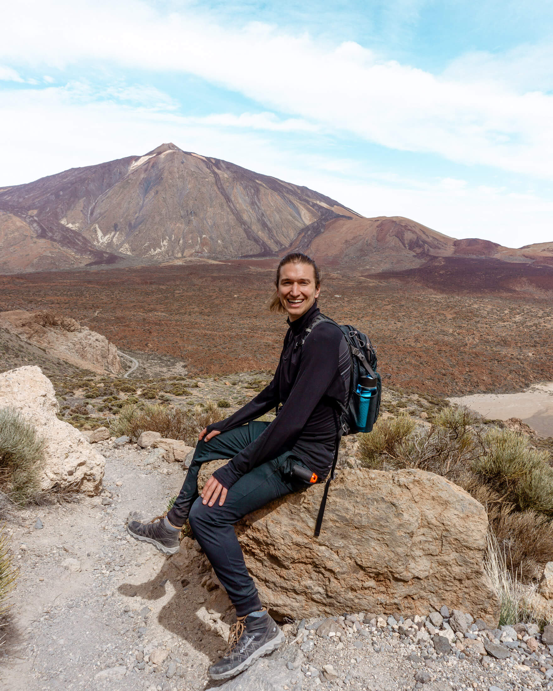
The best view of the tallest mountain in Spain is right at the summit of Guajara. The hike definitely makes you work for the view which makes it even more rewarding once you reach the top.
The hike itself we would rate as hard because of the steep incline or decline depending on which way you do the hike since it’s a loop trail.
You’re in the middle of a lava field with basically no cover hiking up a mountain and absolutely no spots for shade!
It’s a proper hike but the views from the top are absolutely worth it. It’s one of our favourite hiking trails in Tenerife.
The hike itself actually starts right at the information center in the parking lot which is very convenient because you can just leave your car there and parking is free.
Go check out the information center and ask any questions you may have and then embark on the hike up Guajara.
Renting a car for this one is highly recommended but busses also go to Las Cañadas del Teide (the national park where Guajara is located) so there are a few options to get to the hike!
Practical information about the Mount Guajara Hike
Distance: 10.3 km return / 6.4 miles return
Elevation: 677 m / 2221 ft. elevation gain
Type: Loop Trail
Length: 4 – 5 hours (taking your time and taking pictures)
Difficulty: Moderate – Hard (walking trail)
Rating: 4 out of 5 stars
Click here to see a map of the beginning of the Mount Guajara trail
Route Directions
Step #1: Starting at the information center of Cañada Blanca
The trail officially starts at the information center which is quite convenient because you can go ask the park staff any questions about the area or the hike you may have.
They do speak great English too which was great because none of us really speak Spanish, unfortunately (unless our high school Spanish counts, haha).
Even though we wrote down notes of which trails to take we ended up doing the trail clockwise instead of counter clockwise.
The lady told us that doing it counter clockwise was the better way to hike up Mount Guajara and after doing the hike we completely agreed with her.
So don’t make the same mistake we did and do the hike counter clockwise. All the directions in the post are for doing it that way so you shouldn’t have any problem.
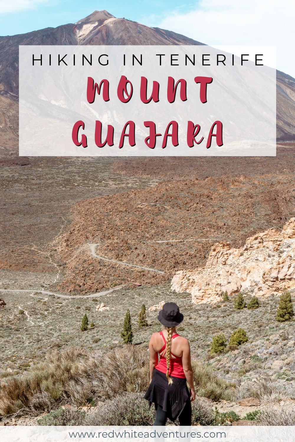
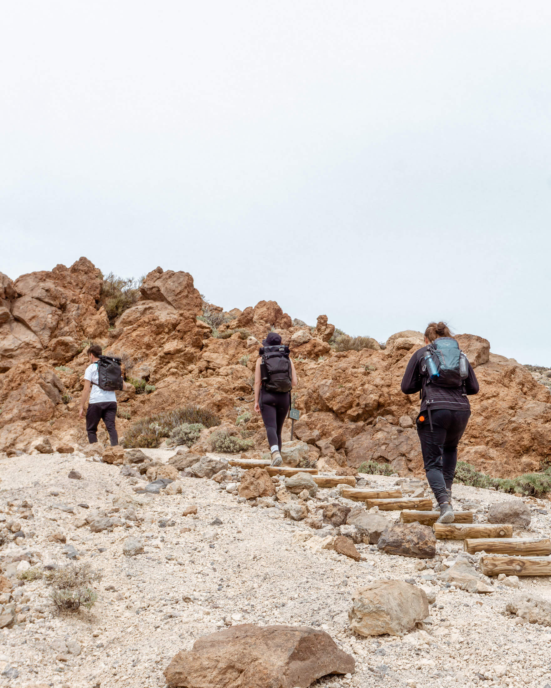
As soon as you walk through the desert looking trail for a few minutes you will come to an intersection with multiple routes.
Don’t go left or right onto the main road but instead continue straight on the smaller trail that looks like it’s leading you up the big mountain that is right ahead of you.
Yup, that’s Mount Guajara and the fun is just about to begin.
Click here to see this step in MapyCZ.
Hiking Tip: Look up the trail on AllTrails before starting your hike 🗺️. You can find important trail information, such as recent wildlife sightings and trail closures. Check out the free version here or get a 7-day free trial of AllTrails+ here.
Step #2: The hike up to Mount Guajara
So this section is the reason why the hike is better to do counter clockwise.
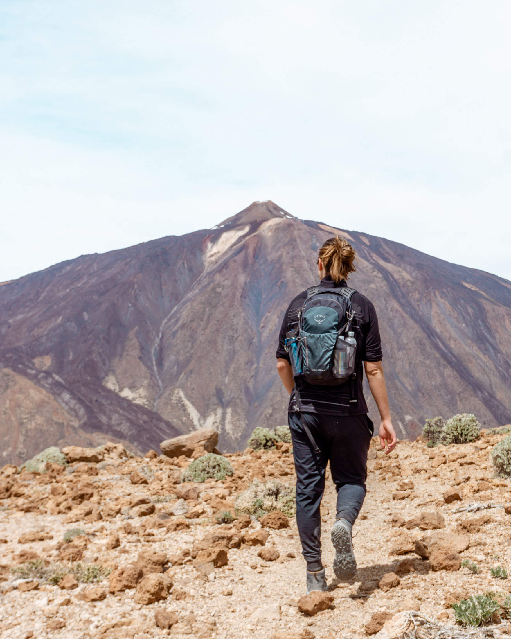
This section is fairly steep with a lot of incline and is much easier on the knees, feet, and body going up instead of down. It’s always nice to get the hard part out of the way first, isn’t it?
It’s a lot of zig-zagging back and forth gaining a ton of elevation. It’s much nicer going up this section and taking in all the views around you.
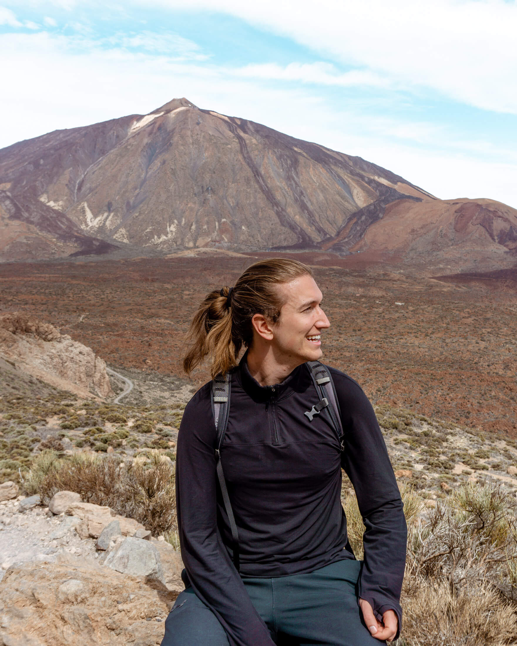
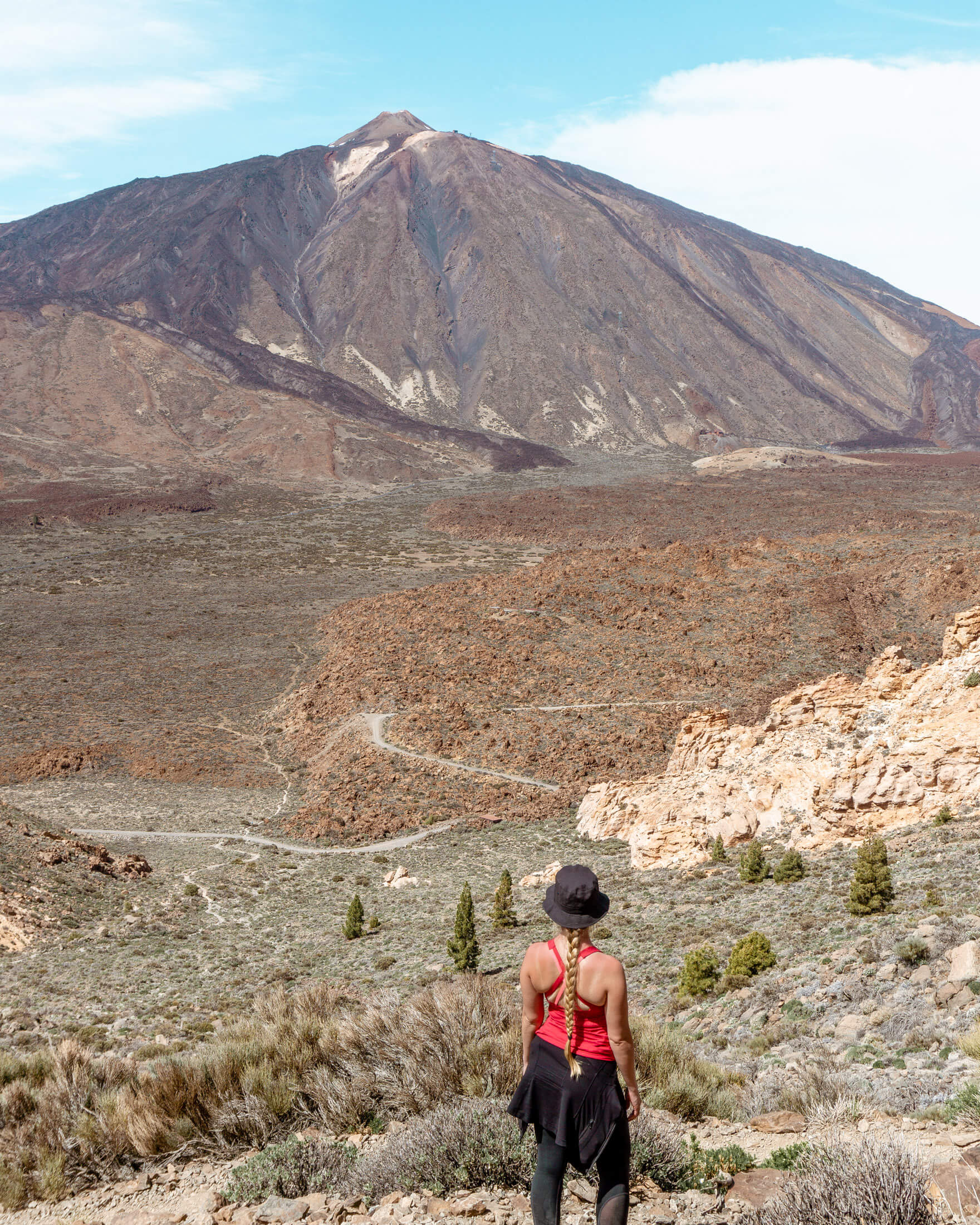
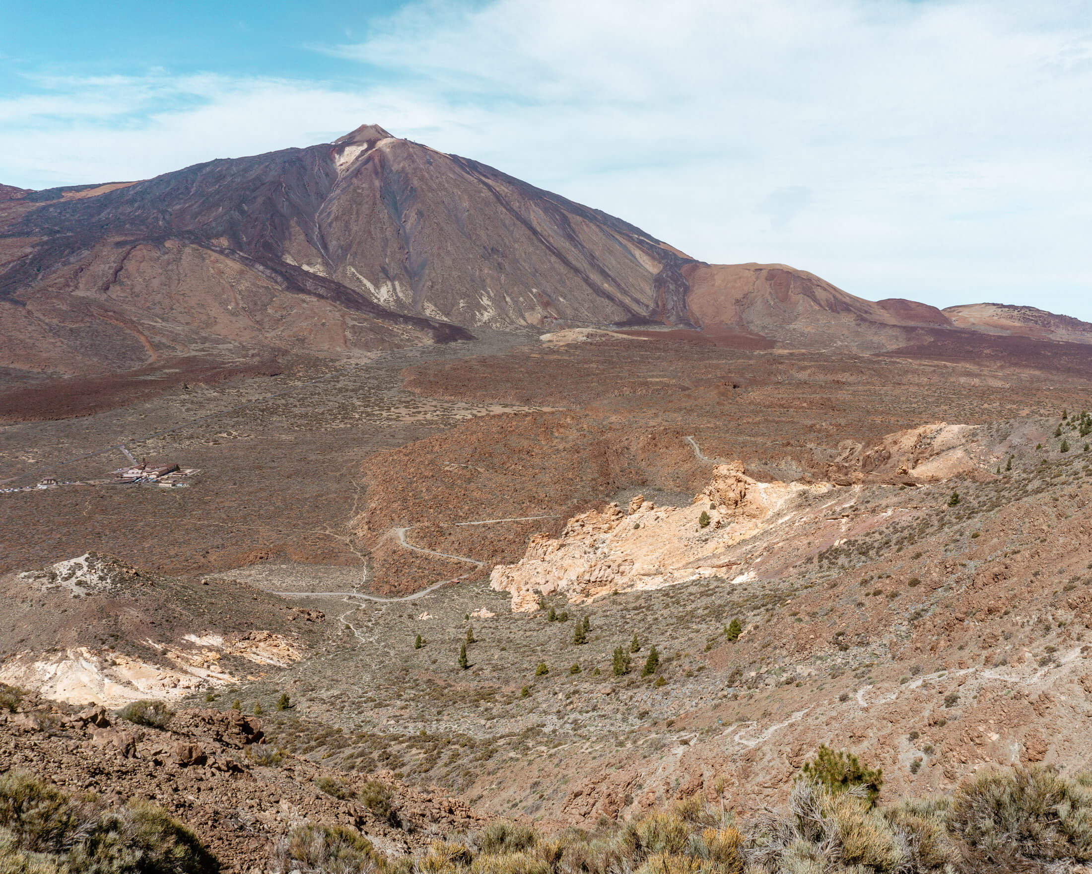
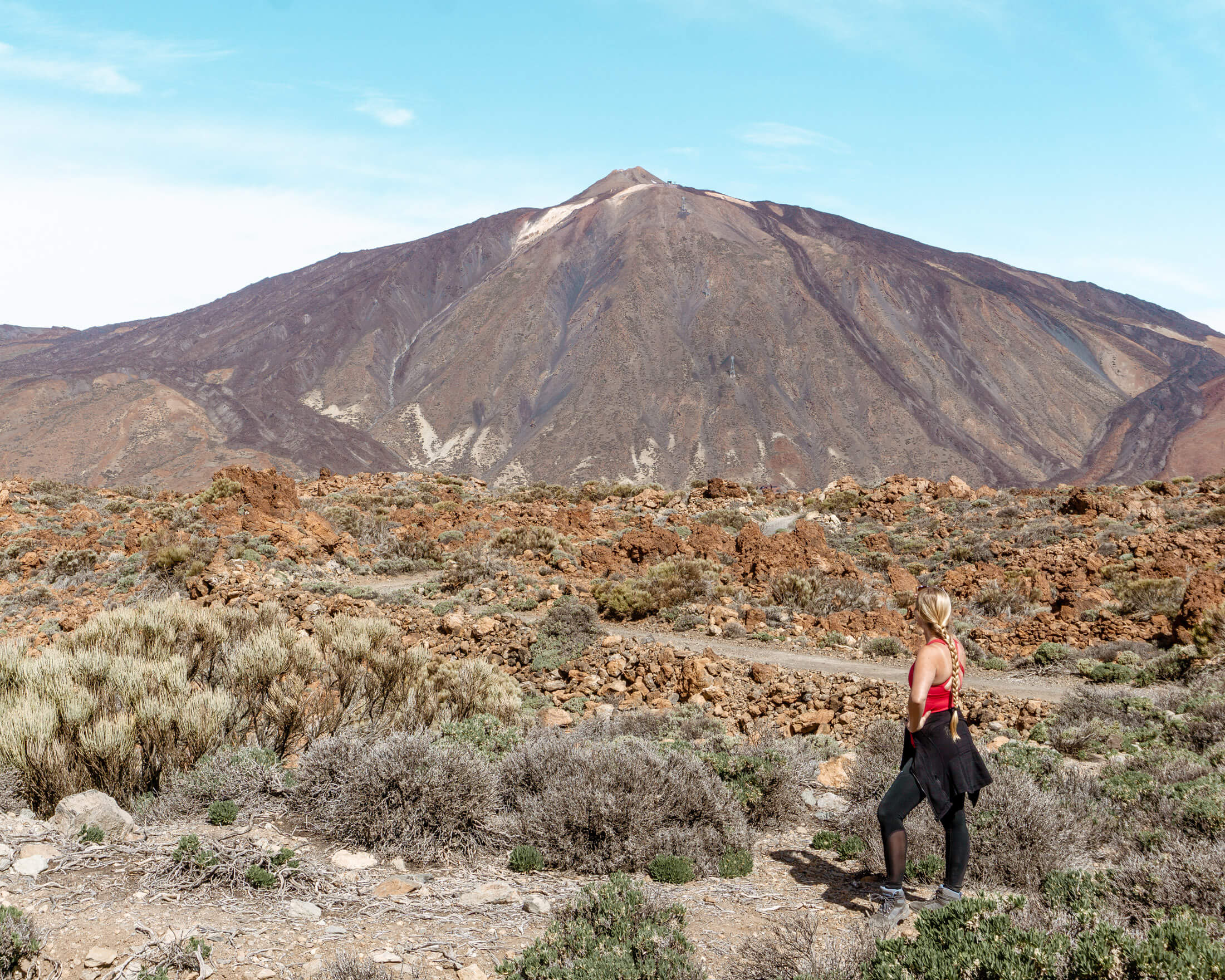
On a clear blue sky day, you’ll be able to see for miles and miles. It feels like a completely different planet because of the volcanic landscape.
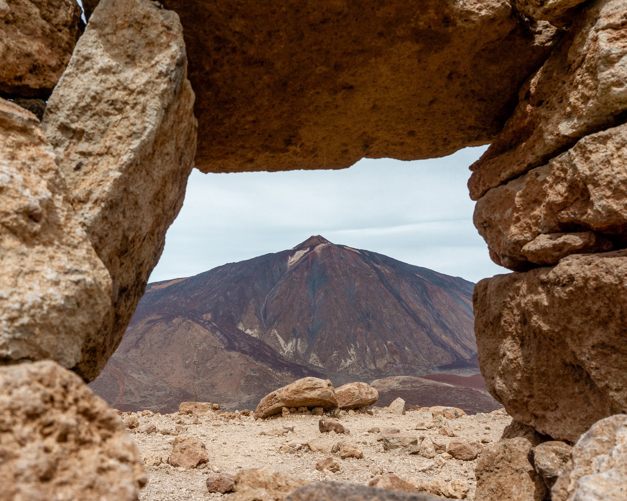
You’ll even have Mt Teide right behind your shoulder to look at the whole way up.
This section is extra difficult because the whole time you’re completely exposed to the sun. Add in the altitude and getting sunburnt doesn’t seem like it’s out of the realm of possibility.
So bring lots of water and sunscreen and apply it before you start this climb up to the summit. We’re talking from experience here 😉
Click here to see this step in MapyCZ.
Step #3: Taking in the views at the summit
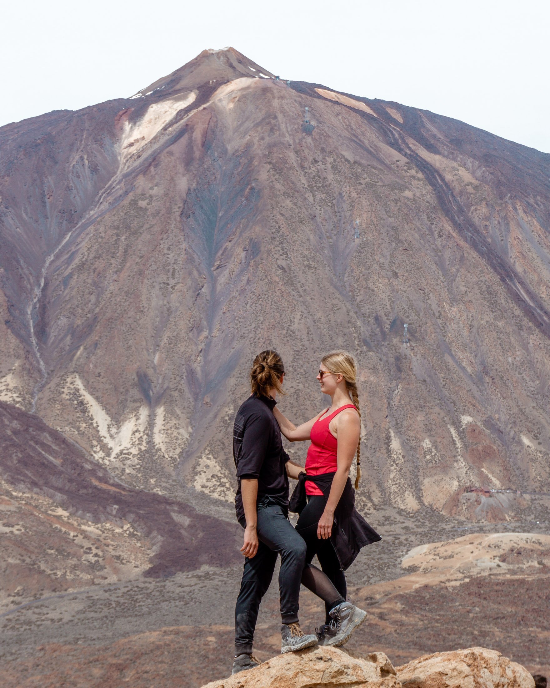
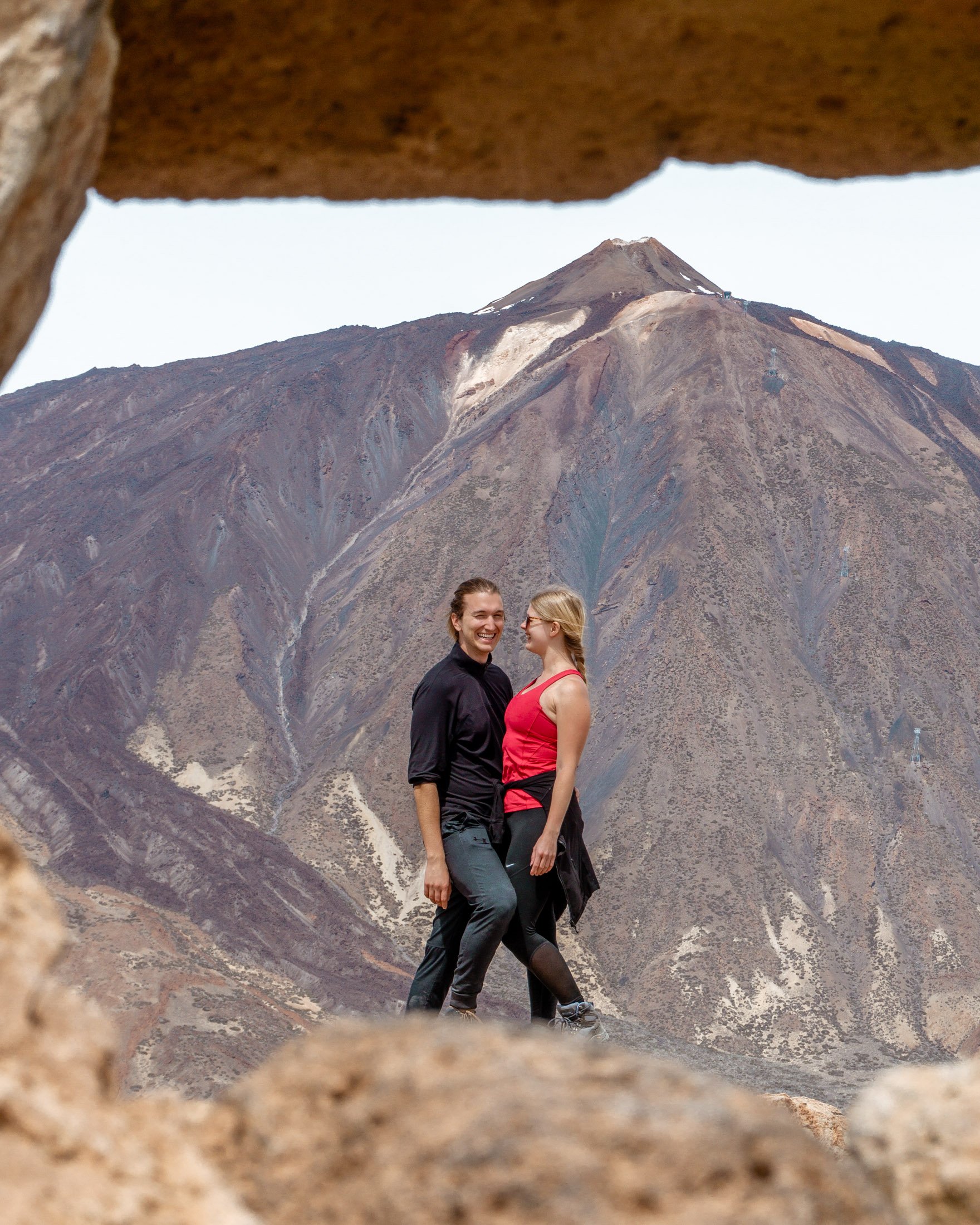
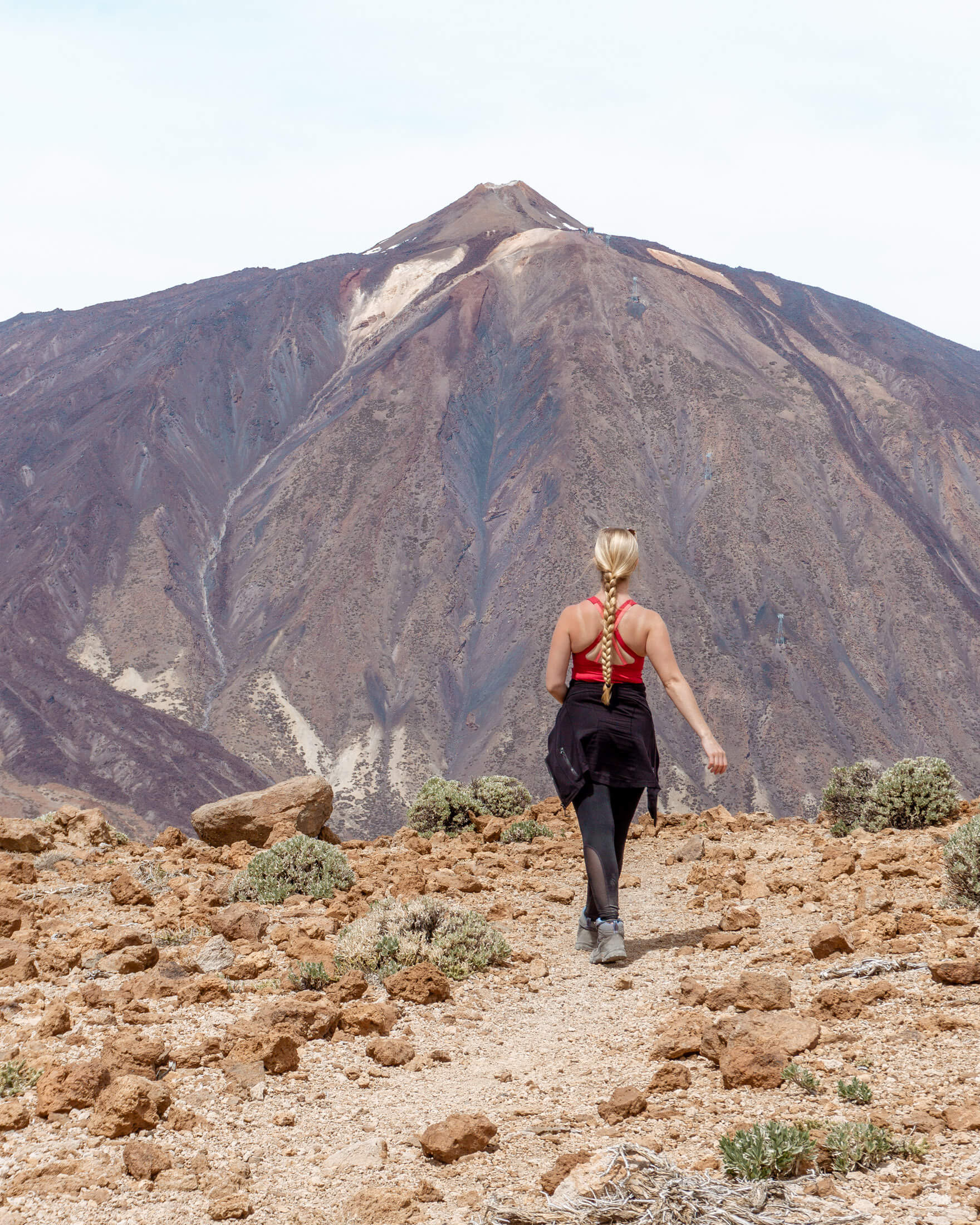
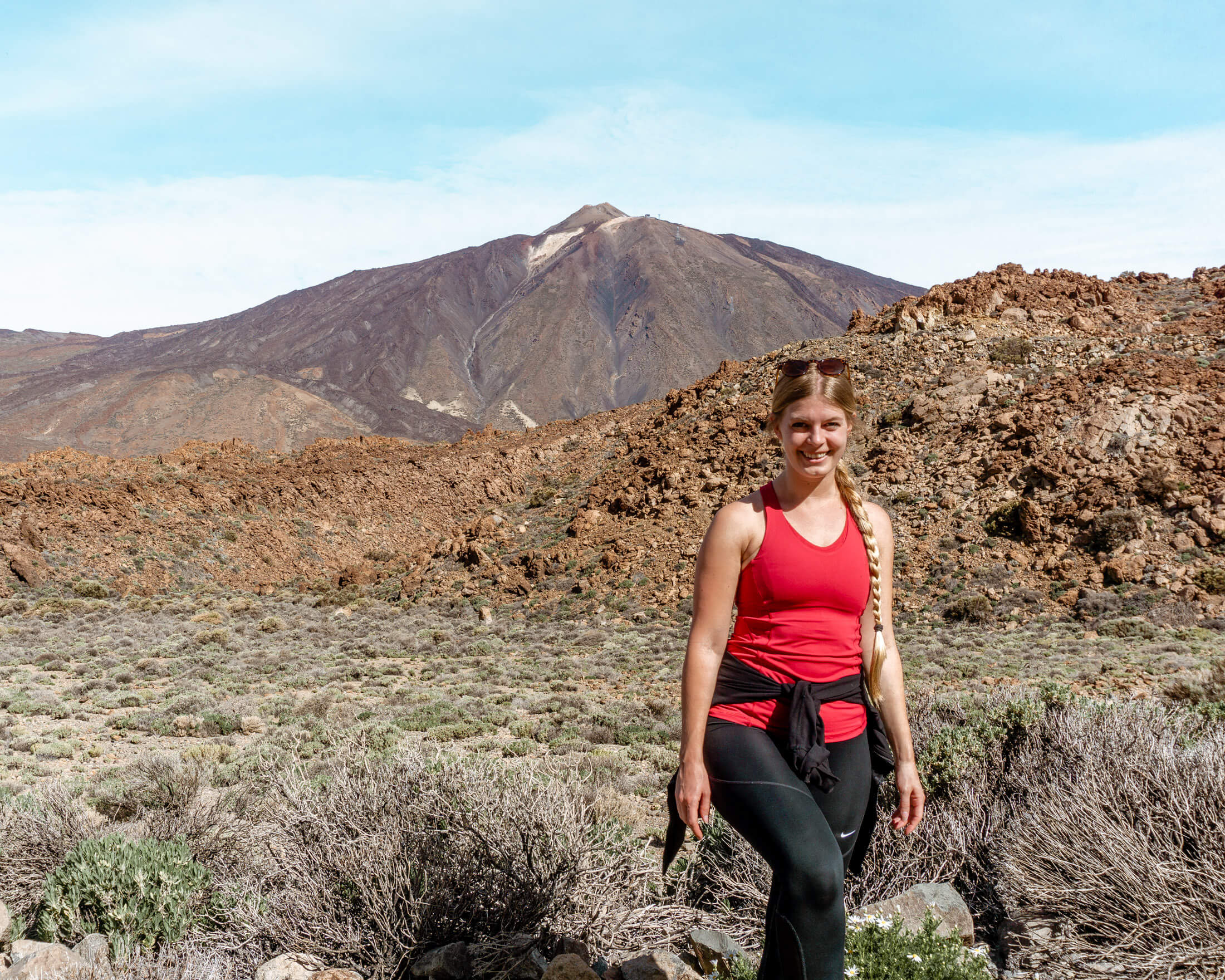
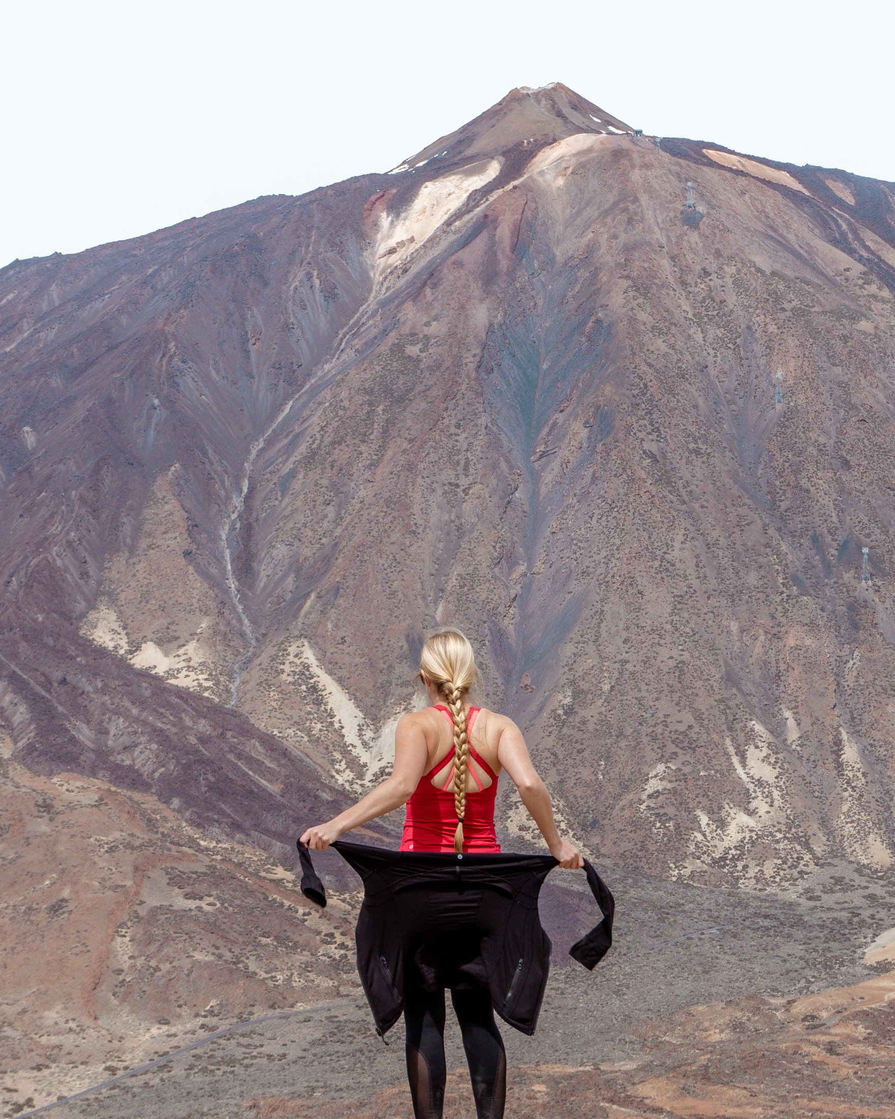
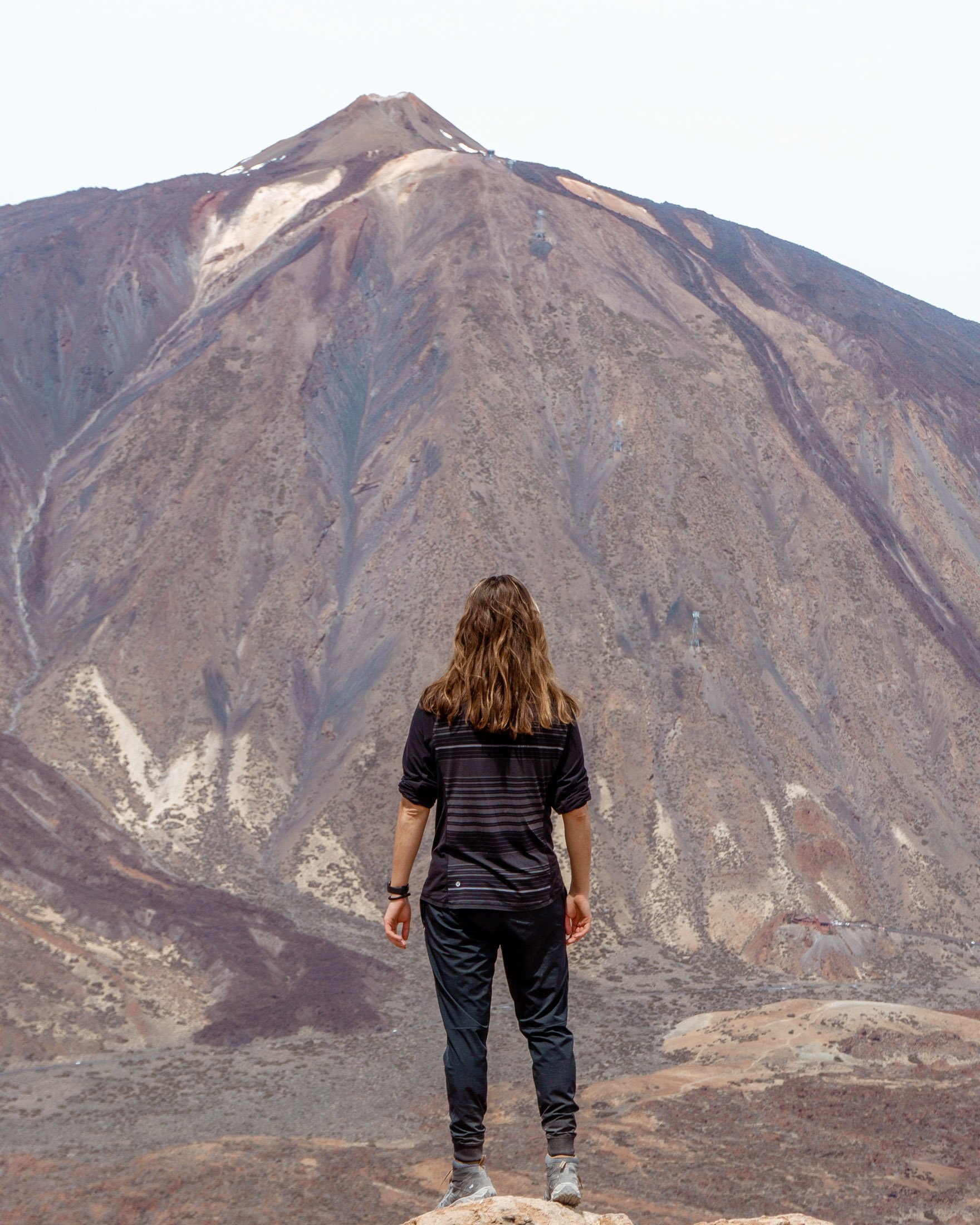
So after hiking up the most difficult section of the hike, you’ll be rewarded with some of the best views in Tenerife and arguably the best view of the famous Mount Teide.
You’ll have nothing between you and Mount Teide besides open air. It feels incredible being so high above the rest of the island!
It’s one of those places where you just feel like you’re on top of the world. The summit of Guajara is surreal and it was worth all the sweat it took to hike up the previous section.
The summit section is quite flat and there is lots of room to roam around and take some great pictures.
On a clear day, you won’t only be able to see Mt Teide from the summit. You will also have a view over multiple of the other Canary Islands including La Gomera and Gran Canaria.
Since the summit is situated at 2718 meters above the sea and since it’s the second tallest mountain on the island it makes for an awesome viewpoint.
The panoramic view you get from the summit is incredible. Tenerife and its elevation is something else!
Click here to see this step in MapyCZ.
Step #4: Down and down back around
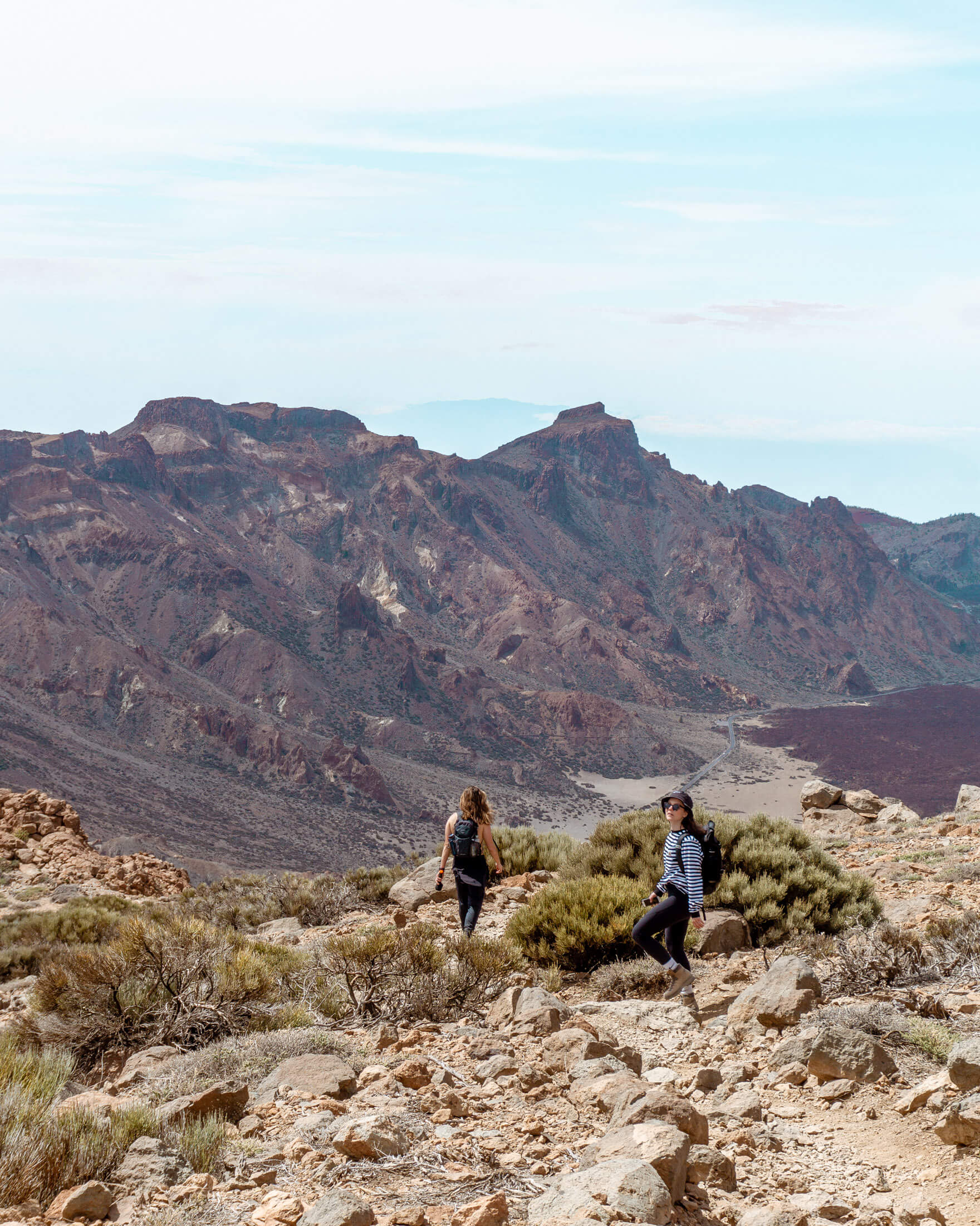
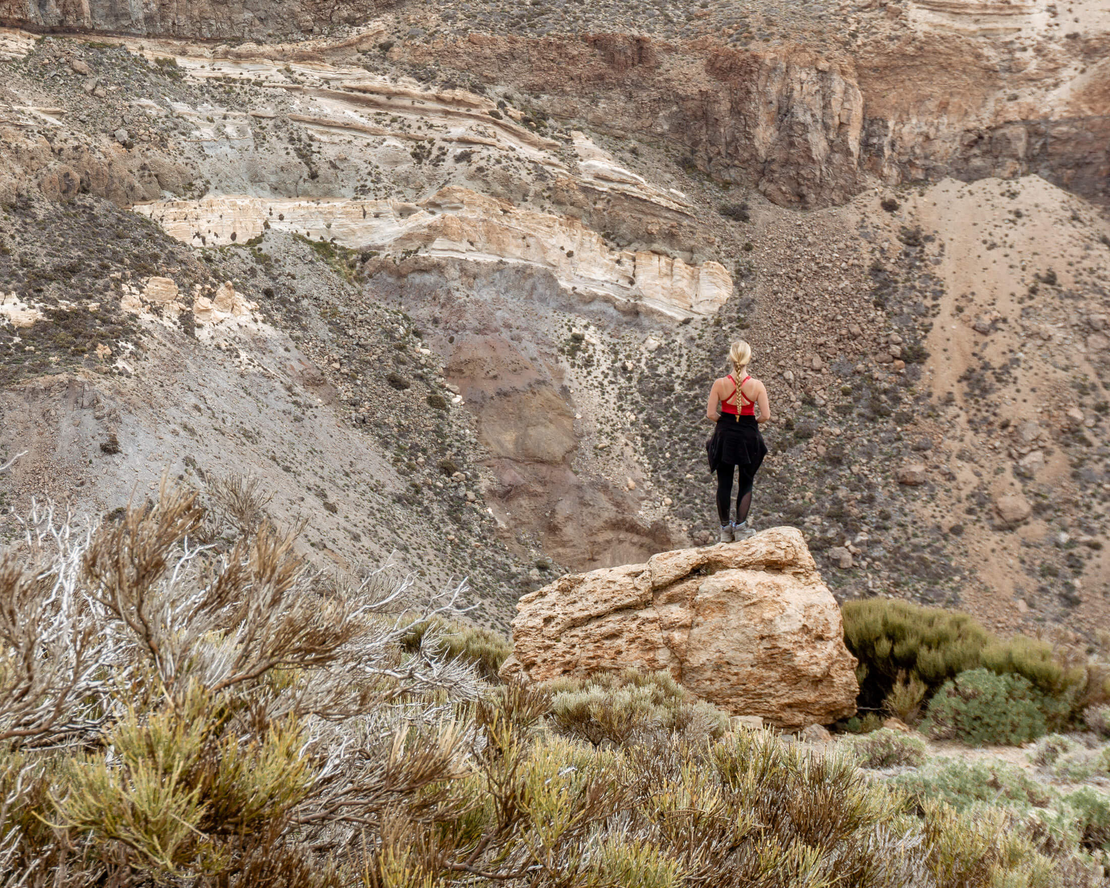
After taking in the beautiful views from the summit you will continue counter clockwise starting the descent back down.
This way is much more pleasant because the way down has a much easier decline. Even though it’s a longer decline it’s much more pleasant on the knees and legs.
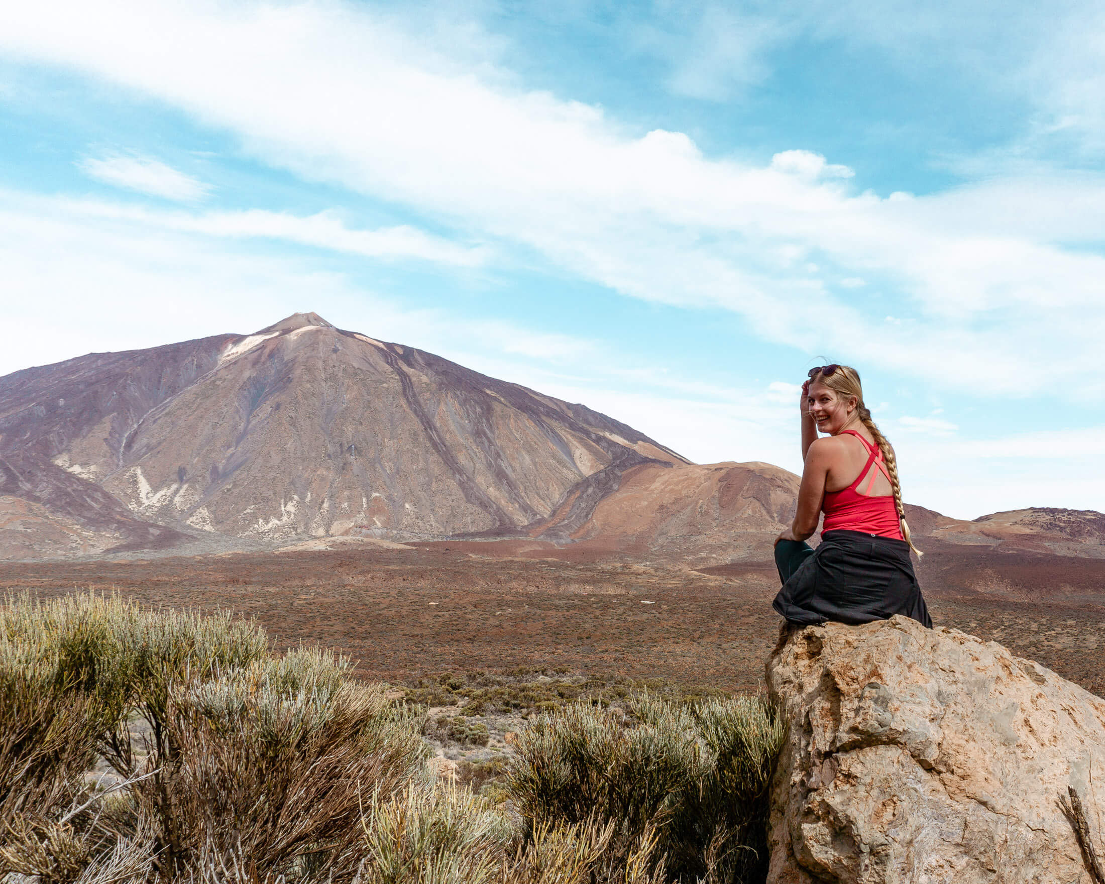
As you go hike down you will have views of Gran Canaria, another one of the Canary Islands, the sea in the distance, and the crazy Mars-like terrain down below.
It’s a very pretty and enjoyable hike back down towards the main path.
The descent will take you down and around Mount Guajara with mountains all around you. With not many plants and trees it truly feels like you’re in a desert. It felt very similar to hiking 7 Falls in Tucson, Arizona.
Once you finish the descent down you will come to a T intersection where a main trail crosses. You will take a left onto this trail which will lead you back towards the Cañada Blanca information center.
Along this last stretch, you may run into other groups of people since this trail is connected to some of the longer caminos on the island.
You’ll have one last chance to take in the crazy views of all the fascinating rock formations and lava rocks that have been formed many many years ago. Then you’ll come to your final right turn at the main intersection.
Next thing you’ll know is you’ll be back at the start of the hike and the loop trail is complete! Looking back you’ll understand why we recommend the counter clockwise way and you can thank us later! 😉
Click here to see this step in MapyCZ.
How to get to the start of the Mount Guajara Hike from anywhere in Tenerife
If you want to take your car then we recommend parking at the Cañada Blanca information center. This is basically the starting point for the hike.
Here is the exact point on Google Maps for the information center.
You can also take the bus from almost anywhere on the island. You may have to transfer and the buses may not go that often but you CAN get there by bus.
The bus also stops directly at the information center so it’s perfect. You can check out Rome2Rio and change the starting city and you’ll be able to see the bus schedule from where you are.
Also read: The Best Cheap Car Rental in Tenerife
Where to stay when exploring Mount Guajara
Thankfully Tenerife is quite a small island and it actually isn’t too far of a drive no matter where you explore on any given day. You can get to most parts of the island in under two hours by car and a little longer by bus.
We took a car to get to Mount Guajara because it was more convenient and even though the drive was a little wild it was worth it. The bus is also fine but only goes every so often depending on the day so you have to plan a little more.
We can recommend a few places to stay depending on what you’re looking for. Puerto de la Cruz in the North has much more nature and greenery with a more chill vibe.
This is where we stayed. We can also recommend El Médano in the South is a much more of a chill surf town. We also spent 2 days in El Médano and can highly recommend hiking Montaña Roja if you go there.
There are tons of other places to stay on the island that are absolutely worth it but as we mentioned, we have personally stayed in both areas mentioned above and enjoyed our time in each.
You may also like…
- Exploring The Famous Rambla de Castro Trail – Tenerife
- Everything you Need to Know About the Tamaimo-Guama Loop Trail
- The Best Sunset Spot in Tenerife – Montaña Roja
- The Gorgeous Mirador de Las Breñas Hike to Costa de Acentejo
- The Ultimate Packing List for Spain
Before you go hike the Montana Guajara trail

We first recommend checking the weather to make sure it’s not too windy or rainy. You’re going to be so exposed on the hike and at such elevations, you don’t want to be underprepared.
You can see the weather for Montana Guajara here.
We’d also recommend checking the bus schedule. Especially if you’re going on a weekday where busses don’t run as often. Just to make sure you don’t have to wait too long once you’ve done the hike.
From the moment you start the hike give yourself at least 4 hours to complete the hike and maybe even longer to be safe.
👩🏼⚕️ Is your trip insured?
SafetyWing’s Nomad Insurance covers hiking and mountaineering up to 4500 meters 🏔️
What to bring on the trail
We hiked up Guajara on a sunny but chilly day and we definitely underestimated the sun at this elevation and we promised each other to not let any of you make the same mistake!
So remember you are around 2000 meters above sea level and the sun can get blistering in the summer.
Even in the winter season, sunscreen is highly encouraged. You’re exposed to the sun at all times and even if your phone says the temperature is close to zero degrees that’s simply just not the case 😉
So bring:
- Water! If you forget it then go to the gas station and you can buy some there.
- Sunscreen is a must when you go anywhere hiking anywhere in Tenerife! Even if you go early in the morning or late in the afternoon.
- A camelbak (backpack full of water) is never a bad option.
- Bring some food so you can enjoy it at the picnic spot “somewhere along the ridge overlooking the coastline and Mount Teide”.
- Relax, and enjoy the views with a nice PB&J, trail mix, or whatever you like to snack on while hiking!
Also this is a great list of hiking gear that you may need on a hike!
We hope you enjoy this lovely but hard hike right in the middle of the island. There are so many amazing hiking trails in Tenerife, especially in this area.
We hope to share some of the best places on the island and inspire you to get out and explore all these little pockets of awe around the island.
Enjoy hiking up to Mars! It’s fun getting away from the touristy crowds in the city to quieter trails outdoors with amazing views.
Enjoy and stay safe out there!
Love it? Share it!