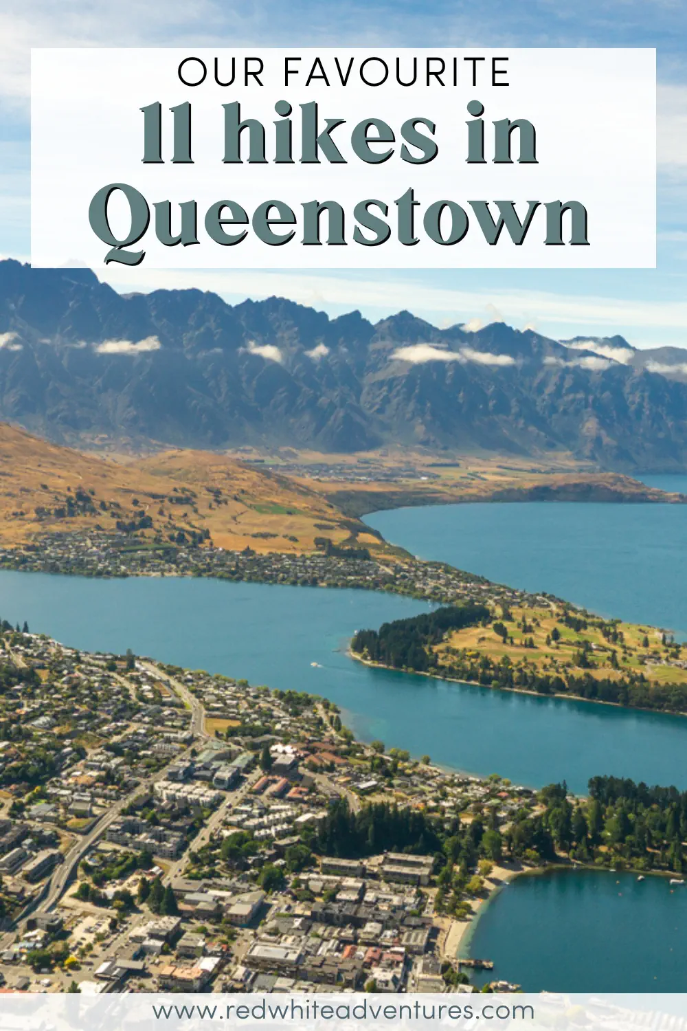
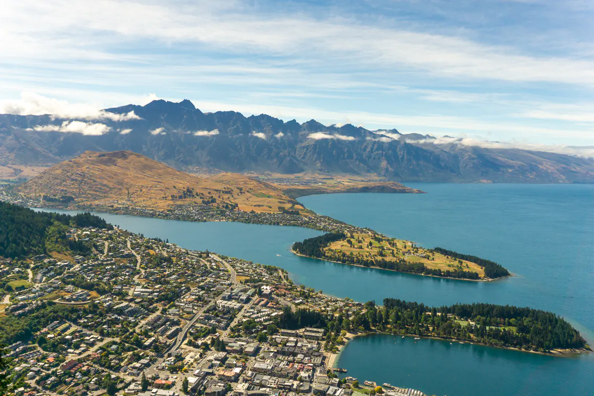
11 Awesome Hikes in Queenstown You Can’t Miss
Queenstown is one of the adventure capitals of the world, and it is surrounded by the most incredible mountains – so it’s probably no surprise that there are some epic hiking trails here!
From easy coastal tracks around Lake Wakatipu to hiking along a water pipe to get to a helicopter pad, there are hikes for all levels of adventure. From the Remarkables to Ben Lomond, the mountains around Queenstown have a never-ending list of peaks and mountains to conquer.
We’ve been lucky enough to spend a lot of time here in Queenstown and go on some pretty unique adventures, and in this post, we’ll share some of our favourite hikes in and near town.
For each hike, we’ve included the distance, elevation gain, difficulty level, and how far from town the trailhead is located to help you plan your hikes and itinerary!
Disclaimer: This post contains affiliate links which means if you decide to use the links and make a valid purchase, we will receive a small commission at no additional cost to you. Thank you for your support!
11 must-do hikes in and near Queenstown
Quick suggestions before you go hiking:
👩🏼⚕️ Make sure your adventures are insured with a reliable travel insurance
☀️ Protect yourself from the sun – sunscreen & a hat are musts
📸 Bring your camera or phone for photos (and a power bank)
🚗 Book your rental car from Queenstown Airport
I think we say this about each and every place in New Zealand that we’ve explored, but we absolutely love Queenstown!
Some people dislike it because it’s slightly more touristy and busy compared to most other places, but, honestly, we think it totally lives up to the hype – and once you get out on the trails, it doesn’t feel as busy.
All of the hikes in this post are either right in Queenstown or less than an hour’s drive from town (all easily accessible by car).
So whether you’re a morning person looking to smash out a hike before everyone gets on the trail, or an afternoon hiker who needs morning coffee, you’ll be able to get to all the trails, no problem.
Hopefully, this list will give you some inspiration for which hikes to do and help you get out there and explore the beautiful land around Q-Town!
Hiking Tip: Look up the trail on AllTrails before starting your hike 🗺️. You can find important trail information, such as recent wildlife sightings and trail closures. Check out the free version here or get a 7-day free trial of AllTrails+ here.
#1 Wye Creek Track near Queenstown

🥾 Distance: 4.0 km / 2.48 miles return
⛰️ Elevation: 332 m / 1089 ft. elevation gain
⏰ Time: 1.5 to 2.5 hours return
🥵 Difficulty: Moderate
🚘 Distance from Queenstown: 25-minute drive (Google Maps directions)
🗺️ Check out the trail map for Wye Creek Track here
The Wye Creek Track is one of the most unique and cool hikes we did in the Queenstown area. Not only is the view from the helicopter pad overlooking Lake Wakatipu epic, but the journey to the actual viewpoint is pretty wild too.
The beginning section is a pretty standard zig-zag hike where you’ll be walking on this dirt gravel trail, which is nothing too exciting. But slowly, as you get further into the hike and into the forest, the real fun starts.
You’ll come across a hydrodam where you’ll find a water pipe, and this will be the pipe you’ll have to walk along to get to the helipad viewpoint! We’re definitely making it seem more extreme than it is because there is this man-made walking bridge on top of the water pipe that you’re walking on – but it is definitely a fun adrenaline activity!
It truly is an awesome hike located under The Remarkables mountain range and only a short drive from Queenstown! The hike itself isn’t actually that long, so it’s great if you just want to get out and explore for a few hours.
☕️ Stop by The Farmhouse in Jack’s Point after your hike for some good food and coffee ☕️
#2 The Tiki Track


🥾 Distance: 4.5 km / 7.2 miles return
⛰️ Elevation: 439 m / 1440 ft. elevation gain
⏰ Time: 2 to 2.5 hours return
🥵 Difficulty: Moderate to hard (it’s steep but not that long)
🚘 Distance from Queenstown: Starts just above town (Google Maps directions)
🗺️ Check out the trail map of the Tiki Track here
The Tiki Track is one of the more well-known hikes in the area. If you want to make your way up to where the gondola goes (where you can ride the luge), but want to go by foot, then we have the perfect trail for you!
The Tiki Track starts in the forest right near the Skyline Gondola, just above Queenstown’s town centre. The trailhead is relatively easy to find, and once you’re on it, the track takes you into the forest, where you’ll make your way up the mountain towards the gondola.
You won’t actually be hiking directly under the gondola, but more through the trees, where you’ll have peace and quiet away from all the crowds of people until you reach the top of the mountain. It’s steep but super rewarding!
This area is popular for mountain biking, and you might also bump into some other hikers who are doing the same trip as you or continuing up to Ben Lomond! (More on that hike below).
If you’re already planning to go to the top of the mountain and don’t want to ride the gondola (to get some exercise or save some money), then this is the best option!
Looking for a place to stay?
Check out our guide on where to stay in Queenstown 🏡
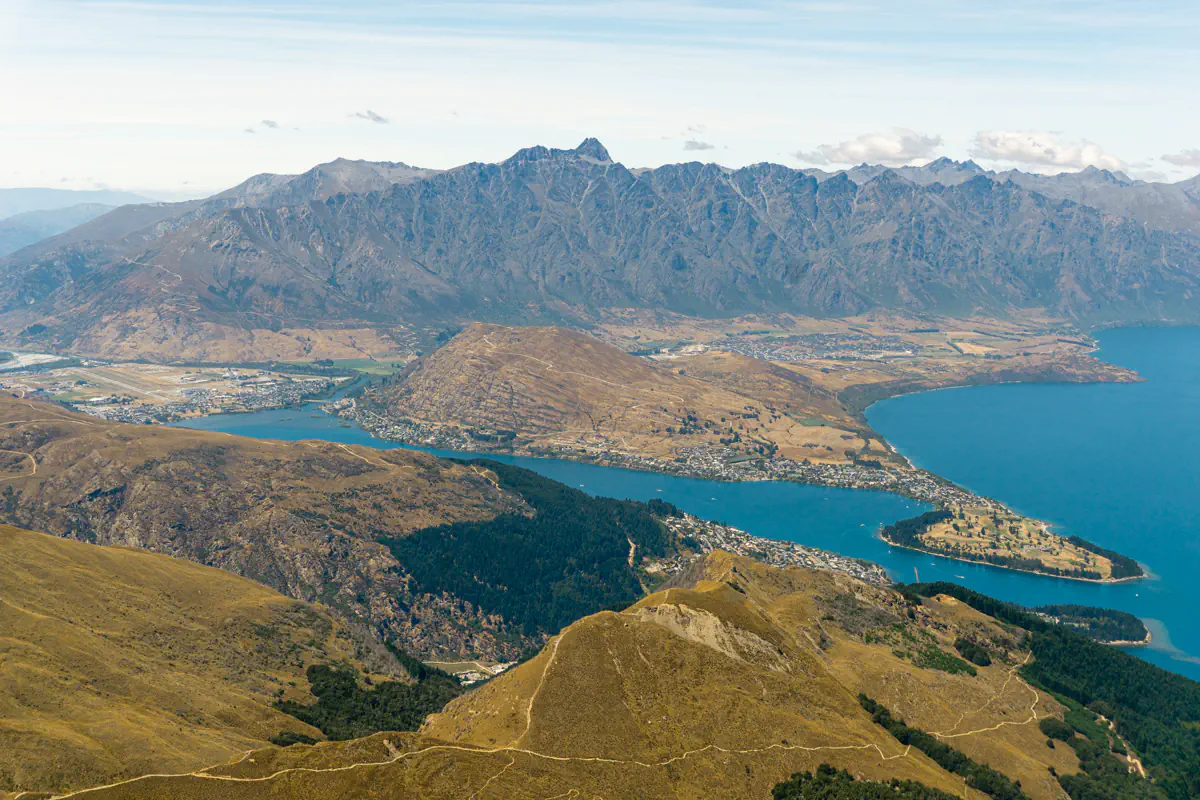
#3 Ben Lomond Peak
🥾 Distance: 15 km / 9.3 miles return
⛰️ Elevation: 1446 m / 4744 ft. elevation gain
⏰ Time: 6 to 8.5 hours return
🥵 Difficulty: Hard
🚡 Distance from Queenstown: In town (extension of Tiki Track) or at the top of the gondola!
🗺️ Check out the trail map for Ben Lomond here
If you love hiking, Ben Lomond is a must-do while you’re in Queenstown! We’ve done this hike twice, and it is an absolute beast, but the view from the peak can’t be beat!
There are a few trailheads for this hike, the main two being at the top of the gondola – or, if you can handle some extra distance and elevation, you can start at the Tiki Track.
If you go from the Tiki Track, this will add roughly 2 hours to the hike – but if you look at the stats above (distance, elevation, and time), we’ve included the full length there. So if you take the gondola, the hike will be a bit shorter (10.8 km vs 15 km, see the details here).
There’s also the option to hike up, and if you’re tired on the way down, you can ride the gondola down at the end of the hike. This is also a great spot to use the bathroom facilities and fill up water, both on the way up and down.
Out of all the hikes on this list, this is the one to do if you really want to conquer a peak and feel like you’re on top of the world! We’re exaggerating a little bit, but it really is a great hike to the summit, and the views are extremely rewarding.
It’s a super well-marked trail, as it’s a very popular hike to do here in Queenstown. You’ll gently hike up the Ben Lomond Saddle, which isn’t too challenging, and then the last bit, when you get below the peak, is the most challenging section!
The Ben Lomond peak is 1748 meters above sea level, so you can imagine the awesome views you’ll get overlooking Queenstown and Lake Wakatipu!
#4 Stunning Alta Lake in the Remarkables


🥾 Distance: 3.4 km / 2.1 miles return
⛰️ Elevation: 207 m / 679 ft. elevation gain
⏰ Time: 1 to 1.5 hours return (time to enjoy Lake Alta included)
🥵 Difficulty: Easy to moderate
🚘 Distance from Queenstown: 45-minute drive (Google Maps directions)
💵 Entry: $15 fee to enter the Remarkables
🗺️ Check out the trail map for Lake Alta here
If you’ve never been up to the Remarkable Ski-Field, then this is your chance to go during the warmer months when it’s not covered in snow, and the hikes are accessible.
The hike up to Lake Alta is relatively short but worth the “longer” drive. Distance-wise, it’s actually still really close to Queenstown, but because you’re driving up the ski road around the mountain, it takes a bit of time to get there.
This hike is another one of those short midday hikes where you can drive from Queenstown and get to the trailhead, hike it, and be back down in a few hours!
Even though it’s short, it’s a really nice hike that takes you up into the ski field and up to Lake Alta, which, if you’ve seen Lord of the Rings, you might recognize from the movies (see the pictures above). If you’re daring enough, you can also hop in the lake and see just how cool the alpine temperature is up here!
Elevation-wise, this is actually the highest hike on this list as the lake is located around 1800 meters, but you only have to cover around 200 of them by foot since you gain over 1000 meters in elevation on the drive!
The drive up is absolutely beautiful, and it’s worth giving yourself some extra time to pull over at the viewpoints and just taking in the views above Queenstown!

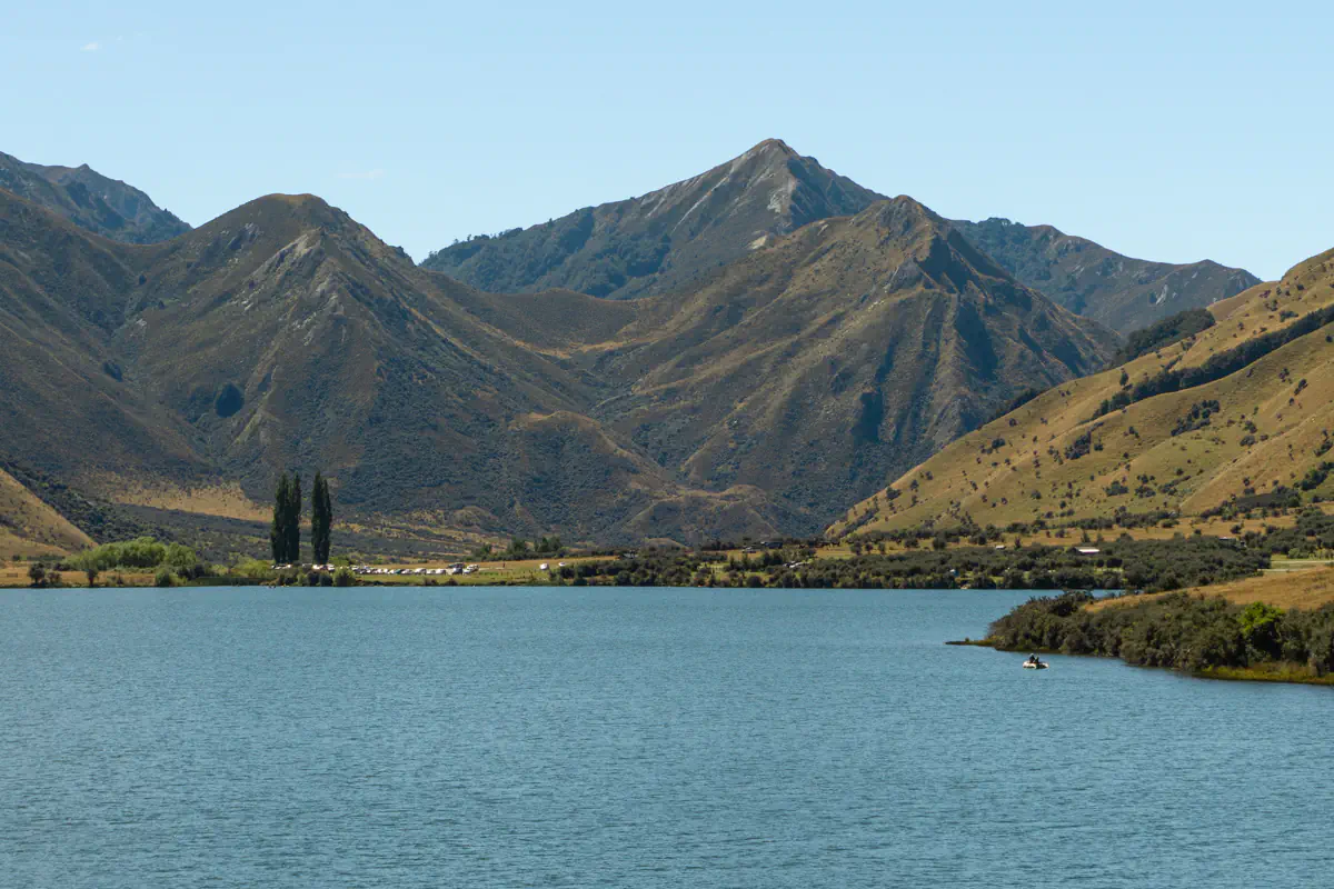
#5 Moke Lake Loop Track
🥾 Distance: 6.9 km / 4.29 miles round trip
⛰️ Elevation: 173 m / 568 ft. elevation gain
⏰ Time: 1.5 to 2 hours return (add time to relax by Moke Lake)
🥵 Difficulty: Moderate
🚘 Distance from Queenstown: 25-minute drive (Google Maps directions)
🗺️ Check out the trail map for Moke Lake here
The Moke Lake Loop Track is an awesome medium-length track just a short drive from Queenstown. Moke Lake is surrounded by mountains and away from all the hustle and bustle of the town, so it’s a great place to explore if you just want to get out on a sunny walk in nature!
The trail itself isn’t too challenging and is a relatively flat loop trail that takes you around Moke Lake with just a bit of elevation. You get awesome views throughout the whole hike, as there’s almost no cover from trees along it! (This also means you should bring sun protection).
At Moke Lake, there’s also a campground area with facilities like places to BBQ and toilets, so you can really make a full day trip out of this if you want. It’s a great place if you’re looking to get out in nature and maybe not hike to the top of a peak on that given day.
You can find more information on the Moke Lake Track here, where we’ve shared photos, a trail map, and more information about the hike and area.
#6 Queenstown Hill Walkway

🥾 Distance: 4.8 km / 3 miles return
⛰️ Elevation: 399 m / 1309 ft. elevation gain
⏰ Time: 2 to 2.5 hours return
🥵 Difficulty: Moderate (it’s steep but not that long of a trail)
🚘 Distance from Queenstown: Starts right in town
🗺️ Check out the trail map for the Queenstown Hill Walk here
One of my favourite parts about Queenstown (besides the coffee shops, delicious restaurants, and epic vibe) is the fact that you can hike right from town!
Some of the best ones are the Tiki Track and Ben Lomond (both of which we mentioned above), and then there’s the Queenstown Hill Walk.
This moderate hike takes you up into the Queenstown Hill Recreation Reserve, which is located right above town – and the viewpoints you’ll get along the way, looking back on Queenstown and Lake Wakatipu, are amazing!
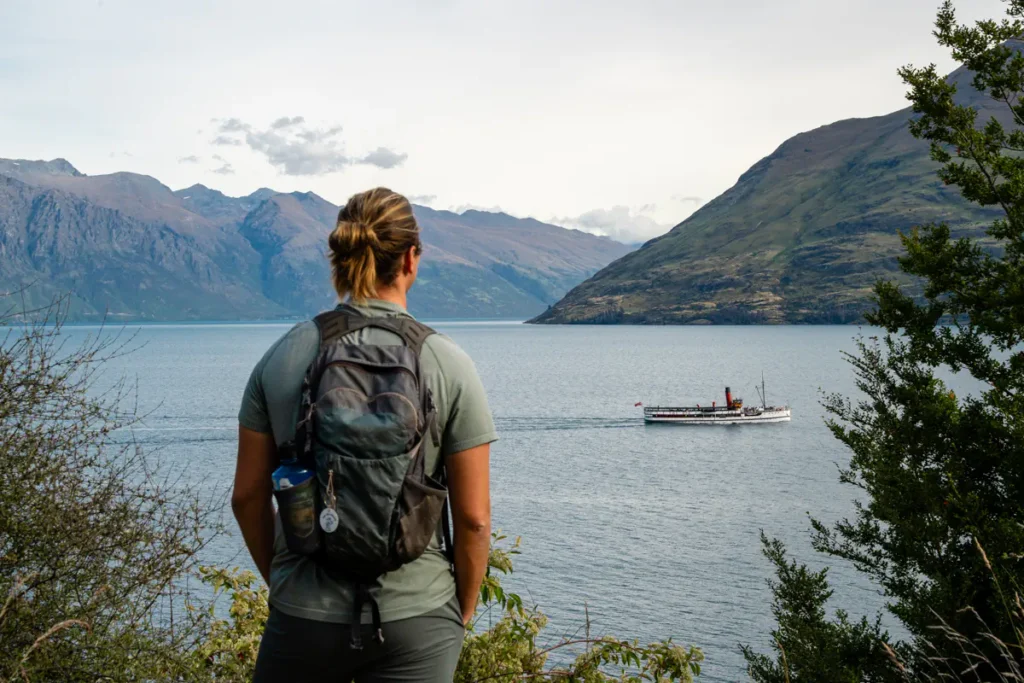
It’s also not a crazy challenging hike, which makes this one of the most popular hikes near Queenstown – but it’s a good workout, and the views are fantastic. Looking back over Lake Wakatipu and sometimes seeing the TSS Earnslaw cruise to Walter Peak Farm is pretty cool!
You can learn more about the Queenstown Hill Trail here, including the way we recommend hiking the trail! It’s a pretty easy trail to follow, and it’s a great hike that you can start right from town.
If you go in the morning, you can complete your hike by going to Bespoke Kitchen, Vudu Cafe, or Marmolada Café afterward. Just make sure to check the opening hours on Google Maps since a lot of coffee shops tend to close early here (around 3 pm).
📍 Want to know about all the best spots in Aotearoa New Zealand?
Then check out our New Zealand Maps with +200 locations around the country that we have visited during our 10 months of living and travelling in NZ! 🗺️
#7 Mt Crichton Loop Track
🥾 Distance: 7.9 km / 4.9 miles round trip
⛰️ Elevation: 319 m / 1047 ft. elevation gain
⏰ Time: 2 to 3 hours
🥵 Difficulty: Moderate
🚘 Distance from Queenstown: 15-minute drive (Google Maps Directions)
🗺️ Check out the trail map for the Mt Crichton Loop Track here
At first, we didn’t think this hike sounded super interesting, but we wanted to try out a hike in an area that we hadn’t hiked in before, so we decided to give it a shot – and I’m really glad we did.
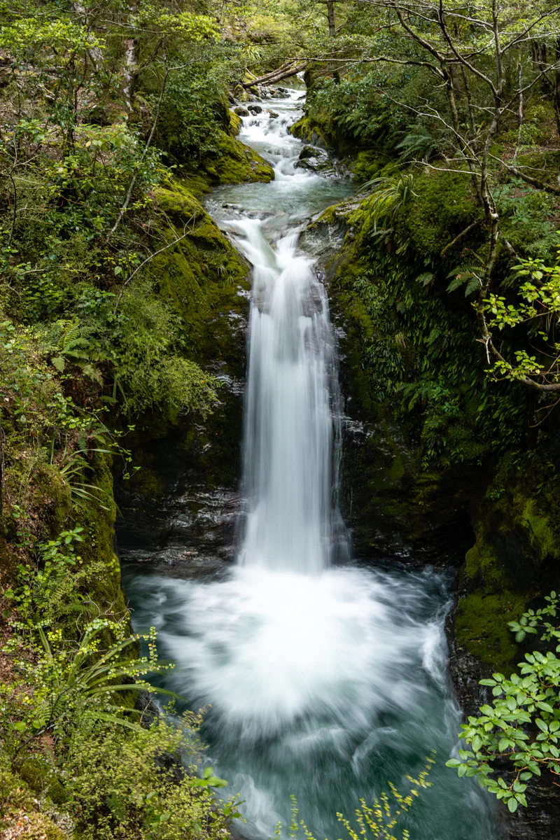
Not only does the Mt Crichton Loop Track take you through beautiful forest, up to a historic hut, past a piece of history from the gold mining times – it also rewards you with a beautiful waterfall and a stunning view of Lake Wakatipu!
This hike really surprised us, and we loved how much the landscape changed throughout the hike – but we did feel like it was both more elevation and distance than mentioned on AllTrails (and in the overview above).
By the time we finished the hike, my Strava recorded 10.5km – so just keep that in mind.
We did also go on a little side quest down to the stream and swam in the water there, which was so refreshing! This was past the “Historic Tunnel” sign. You’ll see it when you go.
If you’re debating swimming too, please make sure it’s safe to do so before going in! Only go when the water level is low – and know that it is extremely cold (maybe 5°C).
Swim or no swim, this is a really nice hike, and we’d definitely recommend it if you have an extended period of time in Queenstown or Glenorchy.
#8 Arrow River Trail to Norman Smith Bridge
🥾 Distance: 3.7 km / 2.3 miles return
⛰️ Elevation: 103 m / 338 ft. elevation gain
⏰ Time: 1 to 1.5 hours return
🥵 Difficulty: Easy to Moderate
🚘 Distance from Queenstown: 25-minute drive (Google Maps Directions)
🗺️ Check out the trail map for the Arrow River Trail here
Stopping by Arrowtown and looking for a short walk to do after lunch or coffee? Then the hike down to Norman Smith Bridge is a great option!
This whole area around Arrowtown is historically known for its gold mining back in the day, and along this trail, you’ll see a few old gold mining settlements.
If you come during late spring/early summer (November through January), you can also see the beautiful lupin flowers that New Zealand is famous for (despite them being an invasive species).
The trail itself is easy to follow and quite short, and at the end-point, you’ll get to the spot that gave the trail its name: The Norman Smith Bridge.
It’s a nice, easy trail walk that’s great to do if you’re already planning to go to Arrowtown. It’s one of the prettiest towns in the whole country, so we can highly recommend you stop by.
#9 Bob’s Cove Viewpoint
🥾 Distance: 3.1 km / 1.9 miles return
⛰️ Elevation: 73 m / 240 ft. elevation gain
⏰ Time: 1 hour return
🥵 Difficulty: Easy
🚘 Distance from Queenstown: 15-minute drive (Google Maps directions)
🗺️ Check out the trail map for Bob’s Cove Viewpoint here
Bob’s Cove is just a short drive outside of Queenstown on the way towards Glenorchy. If you haven’t noticed already, you’ll soon enough figure out that there’s an abundance of hiking trails in this area.
This one starts right off the Glenorchy Queenstown road, where you’ll find quite a big car park (linked above). The car park might be full, so if that’s the case, you can park on the side of the main road. Just be careful with other drivers because they drive quite fast here!
Once you’ve parked, you’ll hike a short distance down to the cove, which might be one of the prettiest spots along the entire lake. The water looks incredible and feels extremely fresh (we went for a swim after the hike!).
Once you get to Bob’s Cove, the hike isn’t done because there’s about 15 minutes of elevation where you’ll get to the viewpoint overlooking Bob’s Cove on one side and the rest of Lake Wakatipu on the other side.
Personally, this is one of the best efforts for reward hikes around Queenstown. It’s not that long, and the hike up to the viewpoint is relatively short, but the view from the top is absolutely incredible!
🥾 Note: We did get “lost” at first because we’d read online that this was a loop track – so we followed the sign at the trail head in the direction of the loop. This was wrong! We suggest you follow the trail map we created here.
#10 Sunshine Bay
🥾 Distance: 6.9 km / 4.3 miles return
⛰️ Elevation: 17 m / 55 ft. elevation gain
⏰ Time: 1-1.5 hours return
🥵 Difficulty: Easy
🚘 Distance from Queenstown: Basically starts in town (here’s the official starting point)
🗺️ Check out the trail map for the Sunshine Bay Trail here
The Sunshine Bay Trail is perfect if you’re looking for an easy walk that starts right from Queenstown. A good idea is to stop by Patagonia Chocolates to grab a delicious ice cream you can take with you on the walk. We did this and can highly recommend it!
From Patagonia, you’ll basically follow the walking trail out of Queenstown towards Glenorchy, where you’ll then connect to the Sunshine Bay Trail.
This is an easy trail that takes you along Lake Wakatipu with beautiful views of the lake along the way. We also saw the TSS Earnslaw on the lake, making its way to Walter Peak Farm (awesome tour, btw).
The trail is super easy to follow and can be done in regular shoes. Of course, don’t forget your swimwear if you plan to swim at Sunshine Bay!
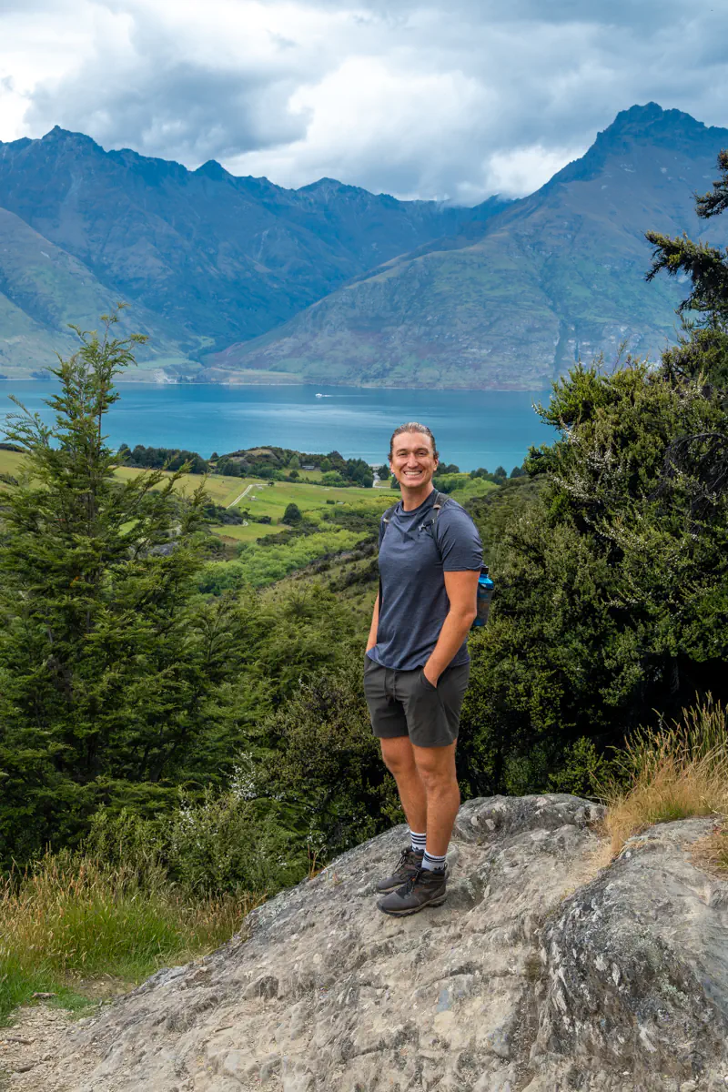
#11 Jacks Point Track
🥾 Distance: 14.8 km / 9.2 miles return
⛰️ Elevation: 471 m / 1545 ft. elevation gain
⏰ Time: 4 to 5 hours return
🥵 Difficulty: Moderate to hard
🚘 Distance from Queenstown: 25-minute drive (Google Maps directions)
🗺️ Check out the trail map for Jacks Point Track here
With a view of the Remarkables on one side and Lake Wakatipu on the other, it’s safe to say this trail has some of the best views in the area.
This is another trail that takes you around a stretch of Lake Wakatipu. It starts right on the edge of Jack’s Point, which is a newer neighbourhood southeast of Queenstown.
It’s quite a long walk, and we’ve done the whole thing before, but I personally recommend maybe doing only half of it unless you’re looking to go on a longer hike.
If you cut the hike short, you can always swing by The Farmhouse. I guess you can do that regardless, but it’s a nice stop because they have some awesome food and great coffee.
The Jacks Point Track is a nice trail if you want to get out of Queenstown and walk somewhere a bit quieter – but I do think it’s a little long to do the full thing, since you have the views right from the get-go. So if you’re not up for the entire distance, don’t worry, you won’t miss much if you only do half.
📍 Want to know about all the best spots in Aotearoa New Zealand?
Then check out our New Zealand Maps with +200 locations around the country that we have visited during our 10 months of living and travelling in NZ! 🗺️
Before you hike in Queenstown (and New Zealand)
Renting a car in New Zealand

Every time we’ve visited New Zealand, we’ve rented a car for the entire duration of our stay. It’s so nice just being able to go whenever we want to explore, and it makes it so much easier to get to the different trailheads as well.
And while this might sound expensive, it usually isn’t if you know where to look and book it in advance. We’ve managed to snag up a few good deals for around $50 NZD, including insurance – during the peak season!
We always use DiscoverCars to book our rental cars (not just in Queenstown, but anywhere we travel) because we trust them and they usually always have the best deals.
You can check it out here or learn more in our blog post about what it entails to rent a car from Queenstown Airport.
Leave no trace
When you go hiking (and do other outdoor adventure activities), always remember to follow the 7 principles of leaving no trace.
This means:
- Plan ahead and prepare
- Travel and camp on durable surfaces
- Dispose of waste properly
- Leave what you find
- Minimize campfire impacts
- Respect wildlife
- Be considerate of others
Check the weather forecast
During the summer months, the weather in Queenstown is usually quite nice with a lot of blue sky days. But you’re still in the alpine, so the weather can change quickly!
Only a few of these hikes really take you to high elevation, where weather can play a big factor, but it’s still good to be prepared and know what you’re getting yourself into.
You can see the weather for the Queenstown area here to have an idea of what to expect on the trails. It’s extra good to check in spring and fall when the weather around here can be a bit more unpredictable and random.
If the weather isn’t great, luckily, there’s enough fun things to do in Queenstown to keep you busy!

Final thoughts on hiking in Queenstown
Queenstown is one of the most amazing places to visit in New Zealand and is home to so many awesome hikes! We hope this post helped you find some inspiration for hikes to do in the area.
Queenstown isn’t all hiking, though, as it’s the adventure capital of New Zealand, and there are so many other fun things to do in the area.
We’ve been back to Queenstown more times than we can count, and every time we get to explore this beautiful part of the country, we try to get out into the mountains. Feel free to DM us on Instagram or leave a comment below if you have any questions about the hikes or Queenstown in general.
It truly is a beautiful part of the country and an awesome place if you love outdoor adventures like hiking and mountain biking!
📍 Save this post for later & share it with a friend