7 Amazing Hikes in Tenerife With Breathtaking Views
We’re not sure if you know this but the hikes in Tenerife are absolutely incredible! We had no idea about the amount of hiking you could do in Tenerife before going on this trip.
We had heard that the island was a great place to meet other digital nomads and great for coworking spaces, great weather, and beaches. So the fact that there are so many possibilities for amazing hikes is the cherry on top.
We did a bunch of hiking around the island since the nature, fauna, and views are all so drastically different around the whole island.
Hiking in the Anaga National Forest is something completely different from doing a coastal walk near Puerto de la Cruz.
One thing a lot of the hikes we did have in common though is that the famous Mt Teide Volcano can be seen from quite a few of them.

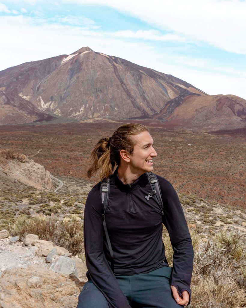
Unfortunately, we didn’t get a chance to hike up Mt Teide (thanks to the pandemic) but if you’re up for one of the best hikes in Tenerife and one of the hardest then we definitely recommend adding this one to the list.
Just make sure you do all the research beforehand to know what you need to hike it up.
Even though Mt Teide isn’t on this list below, we have 7 incredible hiking trails all around Tenerife that are worth checking out. They’re spread out around the island but it is so easy to get around the entire island by public transport or if you rent a car.
Disclosure: this post contains affiliate links which means that if you decide to use them we get a small commission from the platform at no additional cost to you. Thank you <3
7 hikes in Tenerife that will take your breath away
#1 Tamaimo Guama Loop Trail
Practical information about Tamaimo Guama Loop Trail
Distance: 5.7 km return / 3.54 miles return
Elevation: 536 m / 1758 ft. elevation gain
Type: Lollipop Trail (basically a loop trail)
Length: 2 – 3 hours (taking your time and taking pictures)
Difficulty: Moderate – Hard (because of the elevation)
Rating: 4.5 out of 5 stars
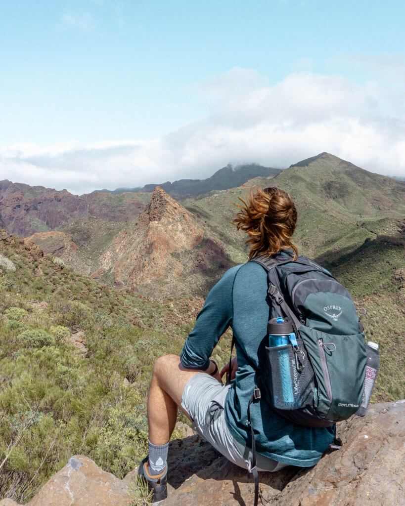
The Tamaimo Guama Loop Trail was actually the first hike we did in Tenerife and may even be our favourite. It is the perfect moderate to hard day hike on the west coast of Tenerife overlooking the cliffs of Los Gigantes. The hike takes place between Santiago Del Teide and Los Gigantes in the small town of Tamaimo.
We recommend renting a car or taking a bus to Tamaimo where the hike begins. Renting a car is the easier of the two but if you’re more comfortable in a bus then that’s probably the better option.
Once you’re in Tamaimo, the trail to the hike and the hike itself is absolutely amazing. One remarkable thing about hiking in Spain is that so many of these trails have some sort of connection to the country’s historic past.
The Tamaimo Guama Loop Trail was an old Camino Real (Royal Road)’ between Puerto de Santiago and Santiago Del Teide.
When you hike along this trail you can imagine the people that used to hike between those two cities centuries ago which we thought was pretty cool!
The views from the top are insane since you see Mount Teide, the famous volcano, on one side and then on the other, you have the mighty cliffs and coastline.
On a clear day, it’ll feel like you can see for hundreds of kilometres out in the distance – and you can actually see some of the other Canary Islands from here. So cool!
We have a whole post about the Tamaimo Guama Loop Trail that includes everything from how to get there, where it starts, and what to bring that you can check out.
There are even some epic pictures to give you an idea of what it looks like without spoiling too much.
Also read: The Best Cheap Car Rental in Tenerife
#2 Punta del Hidalgo to Chinamada
Practical information about Puntal del Hidalgo to Chinamada
Distance: 9.2 km return / 5.71 miles return
Elevation: 627 m / 2057 ft. elevation gain
Type: Out and back
Length: 3 – 3.5 hours return
Difficulty: Moderate
Rating: 4.5 out of 5 stars
Punta del Hidalgo is a small coastal town in Tenerife and that’s where this hike up to Chinamada starts. It’s actually one of two hikes in this post that end up in Chinamada.
The Anaga National Park is such a beautiful area to hike and explore in Tenerife. It’s nothing like the rest of the island and the fauna and nature is just incredible. It definitely feels like the greenest and wettest part of the island from what we could see.
The hike itself isn’t too hard, especially since every few steps you can stop and enjoy the amazing views. There are so many viewpoints along the way that offer epic views of the coastline or the mountains in the area. It’s what Anaga is known for and this hike does not disappoint!
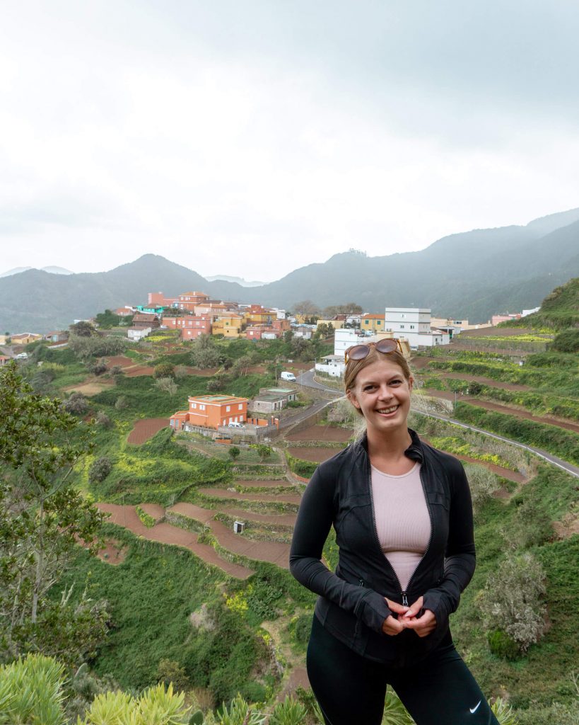
After all the hiking you’ll come to the famous town of Chinamada. This cute town up in the Anaga mountains is known for having houses built into the mountains. Some of these look like they have been around for generations and generations. Quite an interesting town to explore.
It’s a nice place to relax, have a bite to eat, or maybe enjoy a nice ice-cold beer before heading back down to Punta del Hidalgo. All in all, this in-and-out trail makes for a perfect afternoon on a nice sunny day. If you’re looking for more information about Punta del Hidalgo to Chinamada it’s all in this post with some cool pictures from our day hike as well. Enjoy the Anaga National Forest!
#3 Mount Guajara

Practical information about Mount Guajara
Distance: 10.3 km return / 6.4 miles return
Elevation: 677 m / 2221 ft. elevation gain
Type: Loop Trail
Length: 4 – 5 hours (taking your time and taking pictures)
Difficulty: Moderate – Hard (walking trail)
Rating: 4 out of 5 stars
If you’re like us and don’t get a chance to hike up El Teide then do yourself a favour and at least hike up Mount Guajara. From the summit of Guajara, you will hands down get the best view you can imagine of El Teide. It feels like you’re able to see the whole island from the top of Mt Guajara which is located in the centre of the island in the same area as El Teide.
Wherever you look along the hike you’ll feel like you’re on Mars with the reddish/brown rock field all around you. This was all caused by the eruption of Teide many moons ago so it’s pretty cool! It’s the one part of the island that looks like this and it’s so different from Anaga or down south and it’s just so unique.
It might be because the elevation is much higher up Las Cañadas del Teide (the national park where Guajara is located) but the landscape and nature is just so different from the rest of the island and it’s what made this hike so fun and unique.
One thing we can’t stress enough is please bring a ton of water (in an eco-friendly water bottle of course) and some sunscreen because the heat up there is seriously something different. You’re so much higher up and the sun is so strong that you need to come prepared. We use this sunscreen and we absolutely love it because it smells like coconut and is vegan and eco-friendly at the same time!
Besides the heat and some elevation, the hike isn’t too challenging. The trail is nice, and the views are incredible – especially since you have El Teide behind your shoulder for most of it.
If you want more information about the trail and how to get there, check out this complete post on the hike up to the Mount Guajara Summit.
#4 Montaña Roja
Practical information about Montaña Roja Summit.
Distance: 4 km return / 2.5 miles return
Elevation: 131 m / 430 ft. elevation gain
Type: In and out (There are a few trails to the summit though)
Length: 1.5 -2 hours (taking your time and taking pictures)
Difficulty: Moderate (loose gravel path near the top)
Rating: 4 out of 5 stars
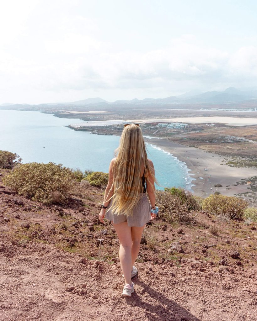
It’s time to explore the Reserva Natural Especial de Montaña Roja. You can call us crazy but from a distance, Montaña Roja looks like a big brown and reddish turtle because of the colour of the rock. So yes, you get to hike up a turtle!
Montana Roja takes you to the southern part of the island near El Médano which is close to the South Airport in Tenerife. We actually saw a few airplanes landing and leaving while we were at the summit which was pretty cool.
Back to the beginning though, once you’re in the park you will notice all the different paths that lead up towards the summit. There isn’t really one right way to hike up towards the summit but multiple so you can really just pick the path that looks best to you.
It’s really not that long of a hike. You can already see the summit before you start. So all you have to do is continue ascending and follow the main path up. Hike up the ridge until you get to the summit and enjoy the view! Some people actually say this is one of the best sunset spots in Tenerife.
It’s a fun short hike if you’re looking for some exercise in the morning, want to make a day trip to this part of the island, or of course the sunset spot in Tenerife. We actually grabbed an ice cream in El Médano before making the quick trip up to the summit.
It’s also a nice little break from the beach and drinking vibe down in El Médano. So lace up your hiking boots and find your way to the top of Montaña Roja.
We have a full post about the crazy views from the summit of Montaña Roja and finding our way around the Reserva Natural Especial. So if you need some more information about the hike you can see it all there.
#5 Cruz del Carmen to Chinamada
Practical information about Cruz del Carmen to Chinamada
Distance: 12 km return / 7.45 miles return
Elevation: 1102 m / 3610 ft. elevation gain
Type: Lollipop trail
Length: 5 – 6 hours (taking your time and taking pictures)
Difficulty: Moderate (nice trail just long)
Rating: 4.5 out of 5 stars
Up in the mountains and far away from the ocean is where you’ll find this beautiful hike between Cruz del Carmen and Chinamada. It was one of our favourite areas in Tenerife to hike. We can only imagine this is what Peru would look like with all these big green mountains.
You’ll travel to the northeastern part of Tenerife deep in the Anaga where you’ll find Cruz del Carmen. Once you get there, you will find the visitor center, a bathroom, a restaurant, and parking. This is the starting point for the adventure that awaits. The starting point is super convenient because there’s a bus stop and parking spots right in front of it.
From there the beautiful views are just around the corner. It’s quite magical because you really don’t know what to expect from the hike unless you’ve done the Punta del Hidalgo to Chinamada hike already. But if you haven’t then you’re in for a surprise. This hike starts in a standard forest with no views in sight and then all of a sudden everything will open up and you’ll be blown away!
The hike slowly starts to become more open and open until you have panoramic views of the lush green mountains all around you. You will hike through a few towns until you get to the iconic town of Chinamada.
We mentioned a little bit about Chinamada in one of the previous hikes but this town is seriously something else. The fact that some of these cave houses have been around for over 500 years is incredible. We guess cave houses are quite durable. The history of Chinamada is very interesting and the fact that locals are still living here is unbelievable. So enjoy your time in Chinamada before making the trek back to Cruz del Carmen.
We have a full post with more information about the hike from Cruz del Carmen to Chinamada including all the directions so you don’t get lost on your way up!
#6 Mirador de las Breñas to Costa Acentejo
Practical information about Mirador de las Breñas to Costa Acentejo
Distance: 3.7km return / 2.3 miles return
Elevation: 310 m / 1017 ft. elevation gain
Type: Lollipop Trail (basically a loop trail)
Length: 1 – 1.5 hours (taking your time and taking pictures)
Difficulty: Easy (walking trail)
Rating: 4 out of 5 stars
The way we found this hike was quite fun. We were searching for some hidden gems, where not as many tourists go around Puerto de la Cruz. We stumbled across the Mirador de Las Breñas hike / coastal walk to Costa Acentejo while randomly searching on Google Maps! It looked beautiful so we had to do it!
The Mirador de Las Brenas hike / coastal walk is an awesome activity to do if you want to get out of Puerto de la Cruz and explore a bit of Tenerife’s more quiet and local side. We had most of the trail to ourselves besides a few friendly locals who were taking their dogs out for a little afternoon hike.
On a sunny day, you can see Mt Teide, Puerto de la Cruz, and of course the beautiful Costa Acentejo coastline that stretches for miles and miles in each direction. There are even plenty of cliff caves that look really cool.
The hike actually starts at the Mirador de Las Breñas viewpoint which you’ll recognize easily. There will be a statue of what looks like a woman holding a child. The starting point is also a great spot to get a picture of Mt Teide far in the background.
Take your time and enjoy the awesome views going down to the coast. It’s not a long hike by any means so you’ll have lots of time to take it all in. There’s even these little cave-looking houses that maybe locals used to live in way back in the day.
For more information about the coastal walk and the viewpoint, check out this post on the Mirador de las Breñas hike. In the post, you can find a few pictures, trail information, and how to get there by car or public transit.
#7 Rambla de Castro Coastal Trail

Practical information about the Rambla de Castro Coastal Trail
Distance: 8.8 km return / 3.54 miles return
Elevation: 536 m / 1758 ft. elevation gain
Type: In and out
Length: 2 – 2.5 hours (taking your time)
Difficulty: Easy (walking trail)
Rating: 4.5 out of 5 stars
The Rambla de Castro coastal walk is an awesome activity to do if you’re in Puerto de la Cruz. It’s a beautiful walk along the coastline just outside of the city. There’s a really nice restaurant at the end of the coastal walk as well. We didn’t eat there the first time we did this coastal walk because it was too busy but we made sure the second time around we stopped by. And friends, it was delicious.
It’s an easy to moderate walking trail that starts in Los Realejos which is a part of Puerto de la Cruz. The trail is an in-and-out trail that will take you along a part of the northern coast of Tenerife which is just absolutely breathtaking.
You’ll enjoy watching the waves crash along the beach, great cliffs, banana plantations, and even an abandoned water tower.
If you’re staying in town it’s quite easy to get to by walking or by public transport. You can also rent a car if you’re coming from another part of the island and park near the beginning of the hiking trail (or even by the restaurant and then you can do the walk backwards).
The Rambla de Castro Coastal Trail can be started from multiple points but we don’t want you to miss the beginning which is actually one of our favorite parts of the whole coastal walk.
Even right before the Maritime Hotel where the hike starts, there’s an awesome viewpoint where you can get some amazing pictures of the waves crashing into the shores. You’ll be way above the cliffs and have an aerial view of the ocean and the coast which is absolutely breathtaking.
For more information about the Rambla de Castro coastal walk, we have a full post on it and how long it should roughly take and where to park, etc. We hope you enjoy this beautiful hike right in Puerto de la Cruz!
Quick list of things that are essential for hiking in Spain
Let’s talk about what items and things are good to bring on a lot of these hikes. We’re used to hiking in a bit milder temperature and we definitely noticed how our energy was drained way sooner hiking in Tenerife because of the heat.
So we have a little list here of things that we recommend for anyone hiking around the island.
- Ankle supporting hiking boots
- Eco-friendly sunscreen
- Eco-friendly water bottle
- Hiking poles
- A good hiking hat
- A small day backpack
These are just the essentials that we recommend for hiking in Tenerife. Mostly due to the lengths, conditions, and type of hiking you’ll do around the island!
Some extras you may want for your hiking trip
One thing about Tenerife is the weather can always be quite unpredictable and it’s better to have a few extra layers just in case you run into some unusual weather. So here’s a little list of a few things you can bring on all the hikes in Tenerife.
You may also like…
- How to Hike Cruz del Carmen to Chinamada – Tenerife
- Exploring The Famous Rambla de Castro Trail – Tenerife
- Everything you Need to Know About the Tamaimo-Guama Loop Trail – Tenerife
- The Best Sunset Spot in Tenerife – Montaña Roja
- The Gorgeous Mirador de Las Breñas Hike to Costa de Acentejo – Tenerife
Enjoy all the best hikes in Tenerife
That’s it! Our list of the best hikes in Tenerife! As you can see from the pictures and the descriptions, the hiking all around the island is quite unique. It’s one of the reasons we loved hiking around this beautiful island.
It’s not your standard hiking and some of the trails are along the coast, in the Anaga National Forest, and even up by El Teide. By doing these 7 hikes you’ll get a good feeling for the different landscapes around Tenerife.
We hope you enjoy exploring the island and if you come across a trail not mentioned on the list let us know in the comments below. We’re always interested in new adventures and hiking trails and we’re sure to be back in Tenerife soon.
Have fun!
Dom & Jo
Red White Adventures
Love it? Share it!