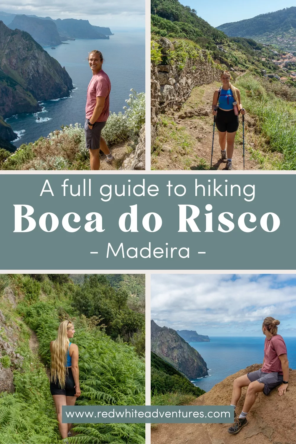
Hiking the Stunning Boca do Risco Coastal Trail
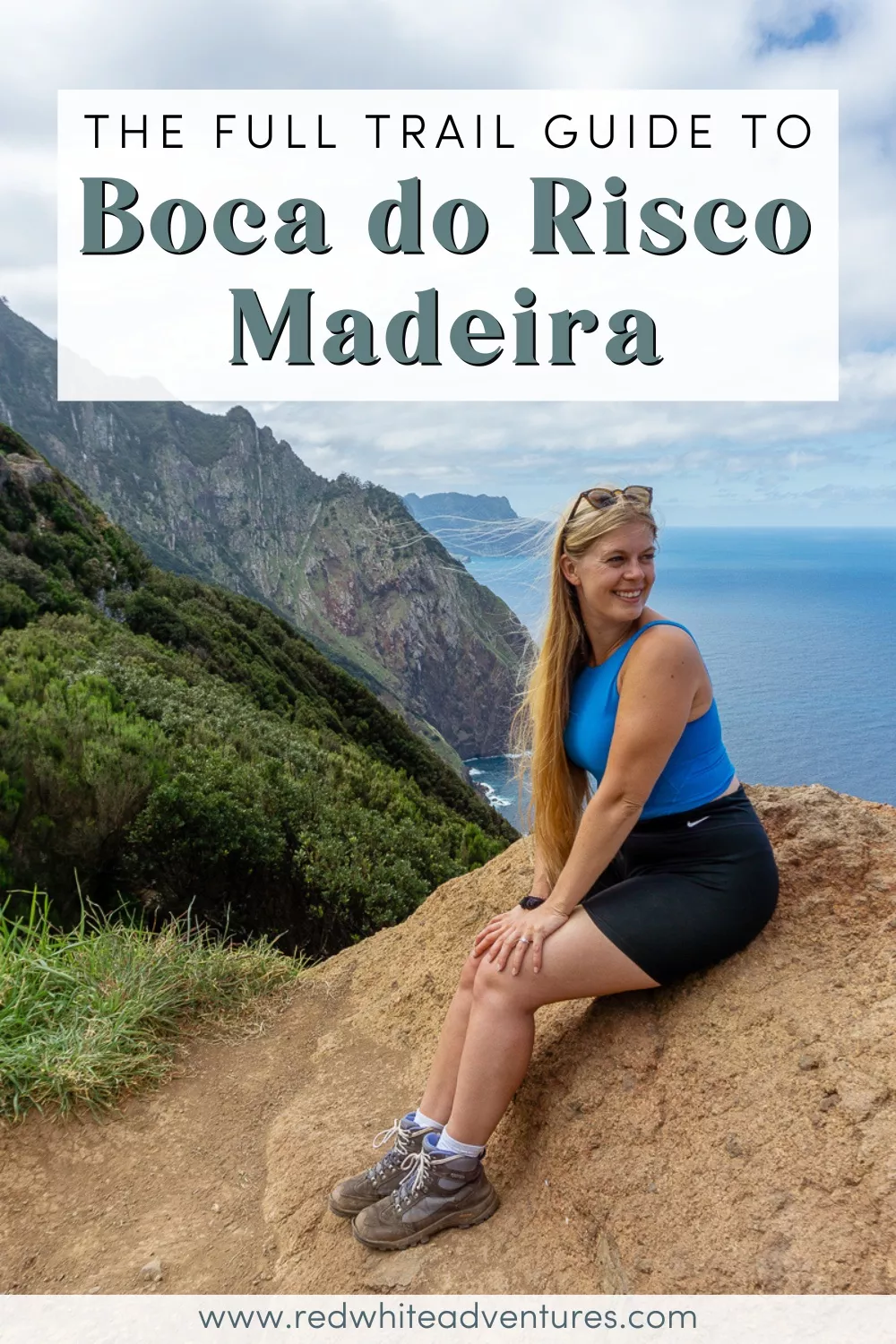
One of the most beautiful coastal hikes in Madeira is the Boca do Risco stretch between Vereda do Larano and Caniçal. The crazy cliffs, insane views, and just all-around stunning trails make this hands down one of our favourite hikes in Madeira.
This famous coastal trail was once used to connect the city of Machico to Caniçal and Porto da Cruz where locals would walk the trail to exchange goods. Now it’s used for ultra runs and for hikers like us to enjoy the stunning trail that connects these coastal cities!
It truly is one of the best hikes in Madeira. As much as we love the levadas, waterfalls, and mountain peaks, these coastal hikes just hit differently.
Disclaimer: This post contains affiliate links which means if you decide to use the links and make a valid purchase, we will receive a small commission at no additional cost to you. Thank you for your support!
The full guide to hiking the Boca do Risco coastal trail
We’ve actually done the neighbouring trail (Vereda do Larano) a few times before so we had a good idea of what to expect – but the Boca do Risco was still out of this world.
Both hikes can be done from the same starting point (which is what we did, but more about that later) but then split at the top. The trail for Boca do Risco then goes east and the Vereda do Larano goes west.
In this post, we are focusing on the Boca do Risco trail and we’ll be sharing everything you need to know about the trail, how to get there, which direction to hike the trail, what to bring, and so much more.
There are a few different ways to do this trail… Some people recommend starting in Caniçal and hiking west to Machico. Some people say to start in Machico and hike east to Caniçal.
We decided to do the hike from Machico and then hike east. We did that for multiple reasons:
We already knew where the trailhead is located and there is a bus that stops right in front of it. Also, we had heard that the trailhead in Caniçal is a little hard to find.
As we mentioned just above, we had already done the Vereda do Larano trail a few times which hikes west so we had a feeling that the views would be slightly similar if we were to do the Boca do Risco Trail from east to west.
We’re very happy with the way we did this trail and recommend you do it the same way!
The views of the Dragon’s Tail (the Ponta de São Lourenço trail) as you hike east along the Boca do Risco towards Caniçal is out of this world!
If none of this makes sense yet, don’t worry! Because in this post, we will break the hike up into sections and make it super easy to follow.
We’ve also put together a trail map for Boca do Risco to make it easy to follow (as you’re reading and as you’re hiking).
Practical information about Boca do Risco Coastal Trail
Distance: 10.4 km / 6.46 miles one way
Elevation: Roughly 748 m / 2454 ft. elevation gain
Type: One-way-trail (can be done as an in-and-out as well)
Length: 5.5-6.5 hours (gives you enough time to enjoy the views)
Difficulty: Hard (but very rewarding)
Rating: 5/5
Click here to see a map of the beginning of the Boca do Risco Trail.
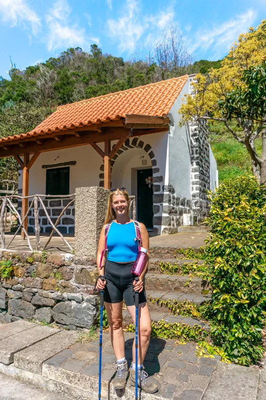
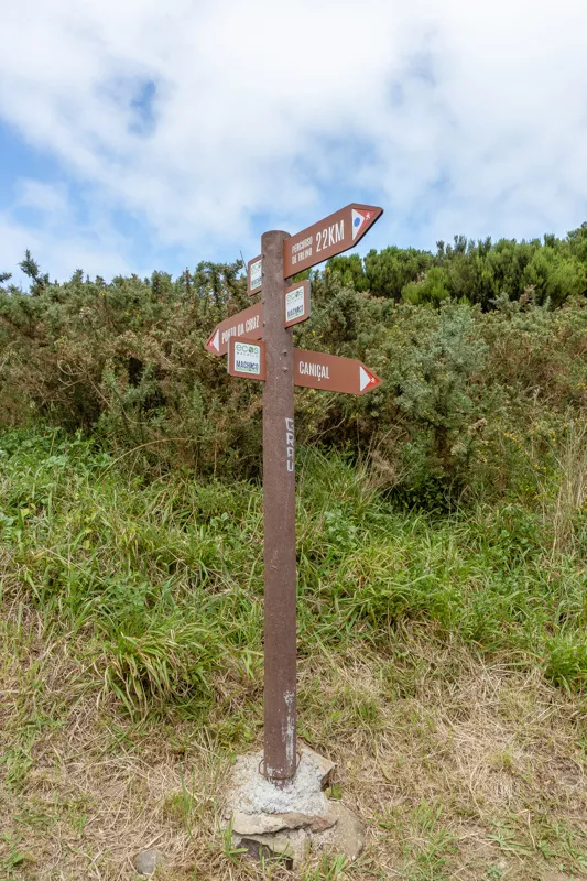
Here’s a picture of the Boca do Risco trailhead:
Getting to the trailhead for the Boca do Risco trail
As we mentioned before, there are different ways you can do this hike. We’re only going to mention one way to keep it simple. It’s also the way we think this trail is the most beautiful.
The trailhead we recommend starting at is the Vereda do Larano trailhead right before the Canical Tunnel. It’s a perfect place to start because there’s actually a bus stop right in front of the trailhead. It’s super convenient.
The bus stop is located right at the Vereda do Larano trailhead which is where you’ll get off to start the hike. We’ll get more into the details on how to take the bus further down this post.
If you do have a car and want to do this as an in-and-out hike, there’s also room on one of the side streets to park your car!
Once you’re at the trailhead you’ll see a little house and Levada do Caniçal. That’s where the hike starts. If you’ve done Vereda do Larano before this will be very familiar to you!
The nature is absolutely breathtaking all over the island but especially over on the eastern coastline. You’re in for a real treat with this one!
Hiking along Levada do Caniçal towards Boca do Risco trail
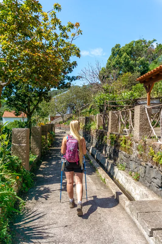
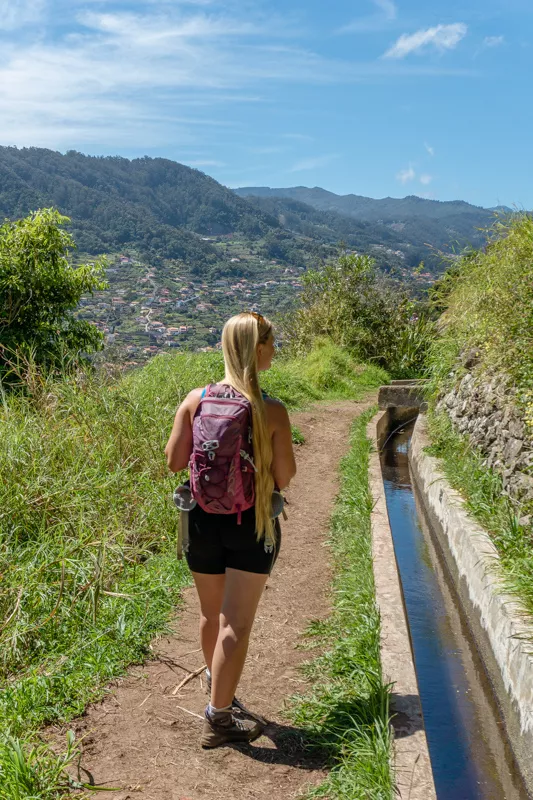
The first bit of the hike is pretty relaxed since you’re hiking along the Levada do Canical without much incline. It’s a nice peaceful section of the hike where you’re out in the countryside above Machico.
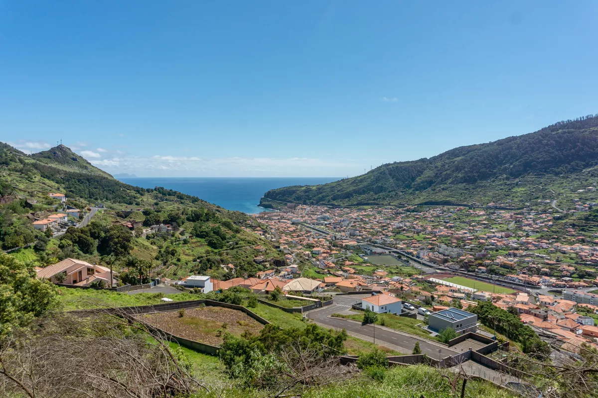
The views looking back at Machico are really cool and seeing all the different country houses, plots of land, and gardens people have made.
The way Madeirans set up their terraces all over the mountain, even on crazy inclines, is so crazy and beautiful.
The way that they maximize their land and grow fruits and vegetables is really fascinating. You may even bump into a local or two as they use these levadas to get water to their properties (that’s originally why the levadas were built).
The levada trails are also the standard way for farmers to get to the farmland that isn’t accessible by road.
📍 Want to know about all the best spots in Madeira?
Then get our Madeira Map → with +135 locations around the island – including the best hikes, coffee shops, waterfalls, and sunset spots – that we have personally visited and love! 🗺️
Cross the road and continue along the Levada do Canical
The trail is really easy to follow in the first section since there’s only really one way to go: Along the levada.
There’s one bit where you have to cross a road and then you’ll connect right back with Levada do Canical on the other side of it.
You can always check back on this trail map for the Boca do Risco Trail to make sure you’re going the right way but you shouldn’t need it until the incline starts.
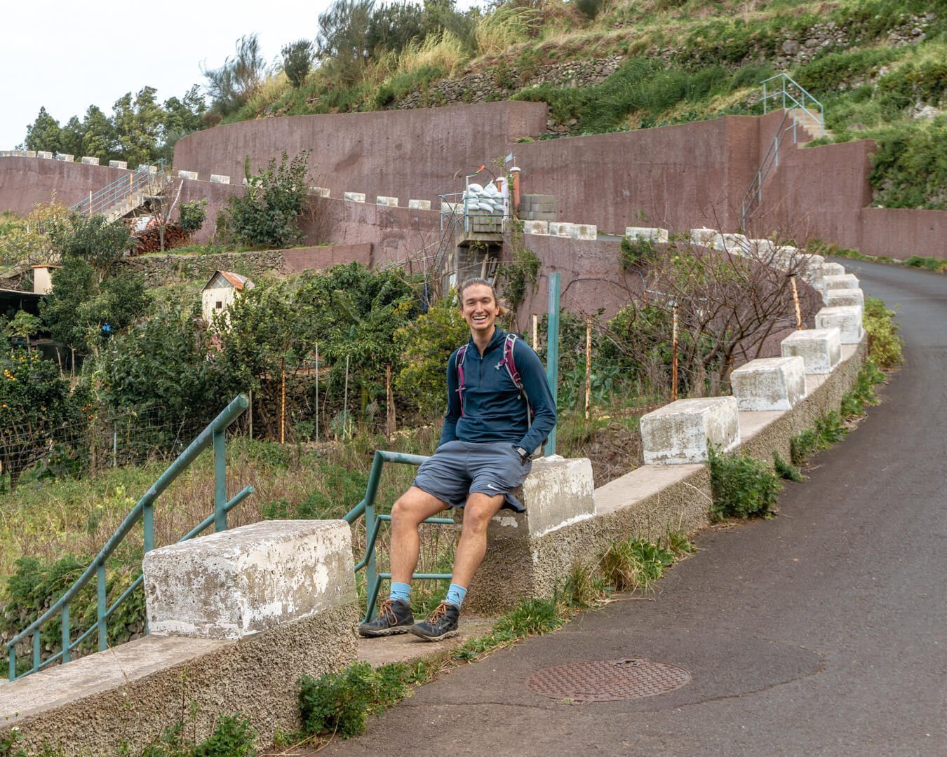
You’ll pass by a country home that has a bunch of toilets that are used as plant pots right before you cross the road and another funky little house as you continue along the Levada.
The nature, trail, and views only get better and better as you get further along the Levada do Canical.
You soon start to gain some elevation and leave the city of Machico behind you as you continue up towards the coast. This is where the harder part of the hike starts!
Hike up Vereda do Larano towards Boca do Risco
Eventually, you’ll have to steer off the Levada do Canical (to the right) and start hiking up towards the coast.
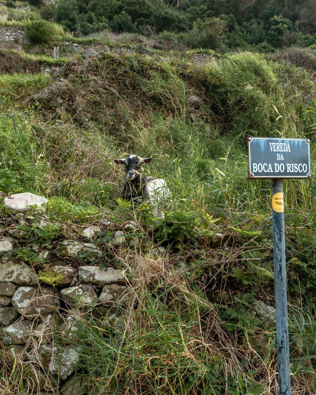
There will be a spot where the trail splits in two with a sign pointing up with the words “Vereda do Boca do Risco”. This is the trail that connects to Boca do Risco and Vereda do Lorano where the coastal section of the hike begins.
The Vereda do Larano is quite a popular hike because it’s the main trail that brings you up to the coast where you can continue both west towards Porto da Cruz or east towards Canical.
We’ve done the Vereda do Larano towards Porto da Cruz before and it’s absolutely stunning but we think the Boca do Risco Trail towards Canical might even be slightly more breathtaking.
It’s hard to say which one is more beautiful.
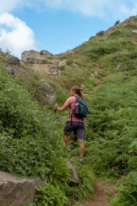
Anyways… As you hike up this section, you’ll get closer and closer to the coast. There’s definitely a bit of elevation at this point but don’t worry… The views are worth it!
Finally, you’ll start to see the trail open up, feel the wind from the coast, and the smell of the fresh air will hit you. That’s when you know you’re close to the coast!
👩🏼⚕️ Is your trip insured?
SafetyWing’s Nomad Insurance covers hiking and mountaineering up to 4500 meters 🏔️
Start the Boca do Risco trail towards Canical
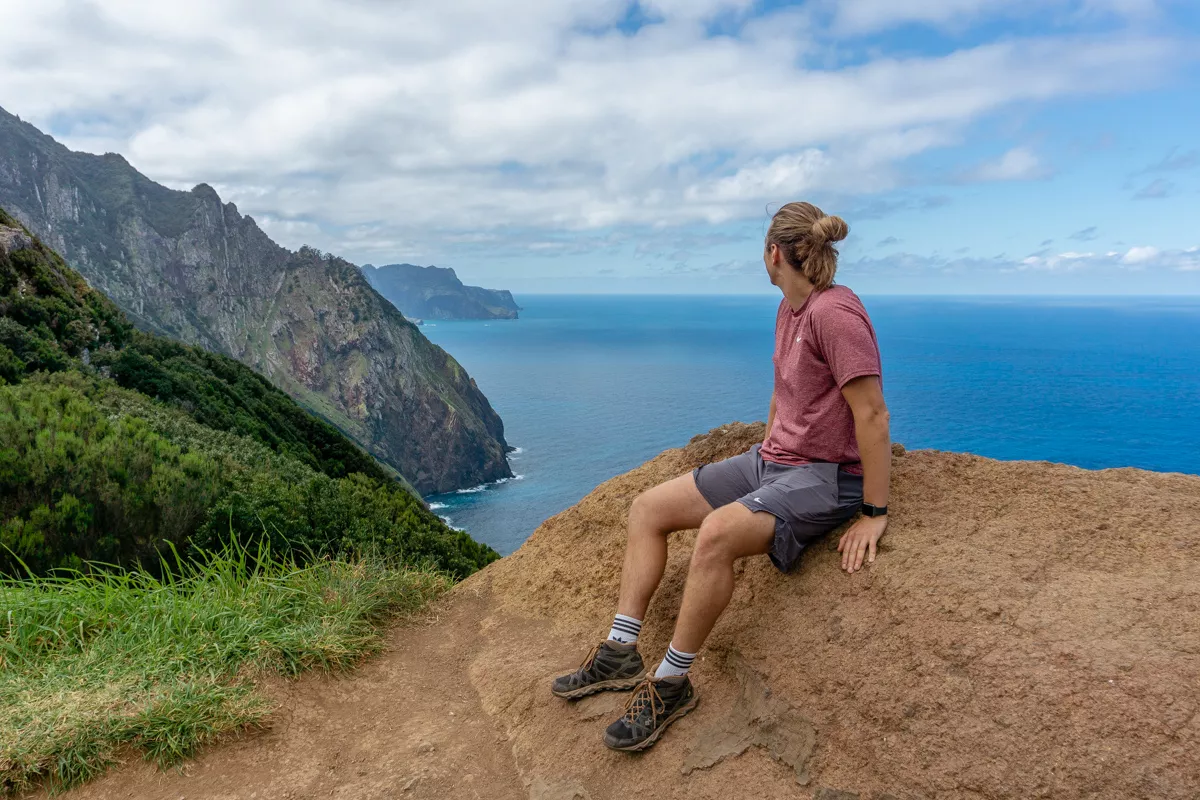
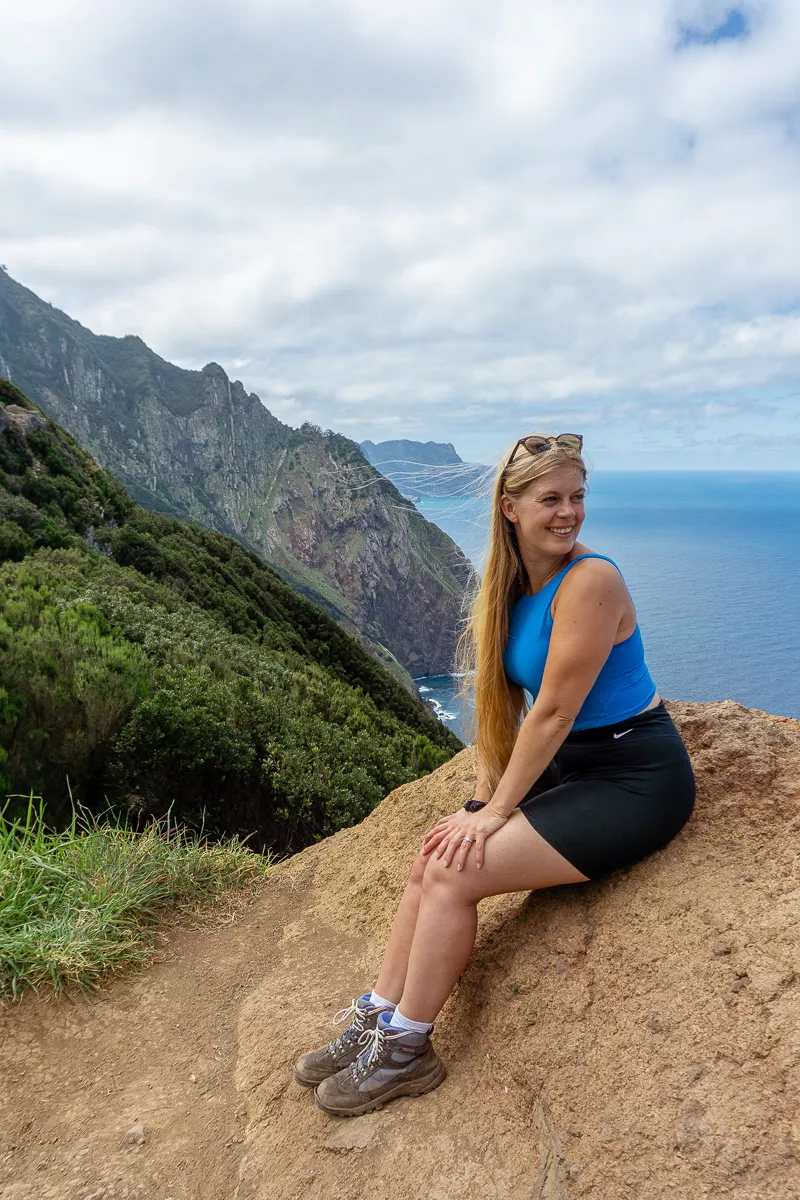
The trail actually splits right before the coastline comes into view so before you head east and make your way to the Boca do Risco trail, there’s a really cool viewpoint right at the coastline you should go check out.
There’s a big rock which you can sit on where you can see the whole coastline. It’s a great spot to have a little snack before continuing the journey along the Boca do Risco towards Canical.
Once you’ve had a little break and are ready to continue, you can start the hike up Boca do Risco. You have to backtrack just a few meters to get back to the sign which you see in the pictures above.
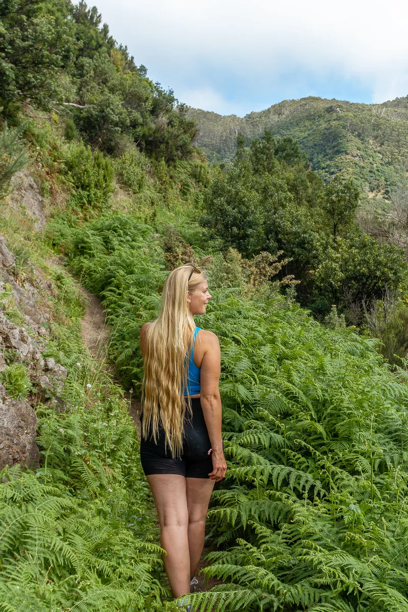
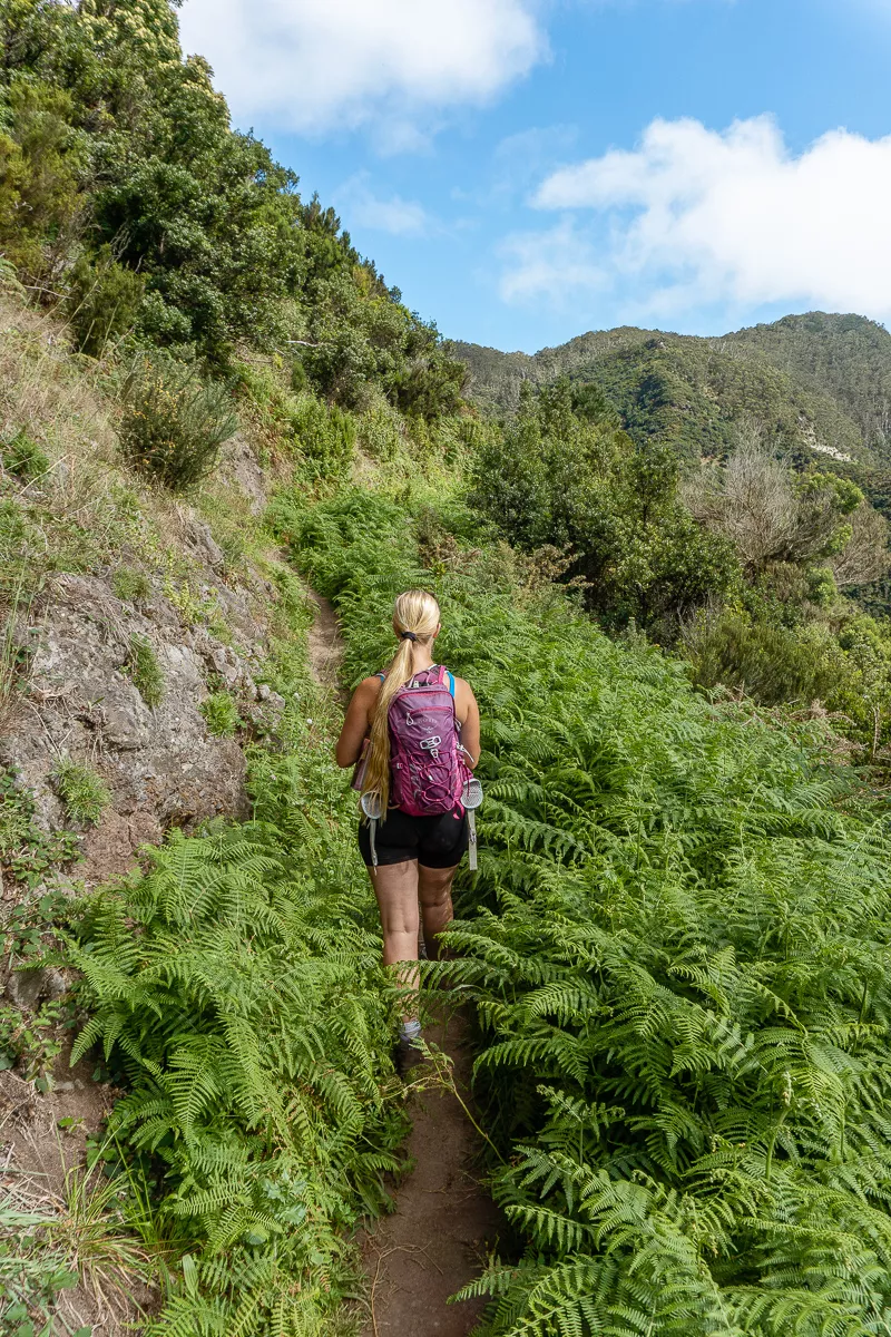
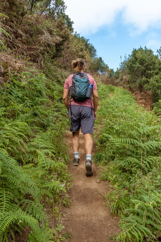
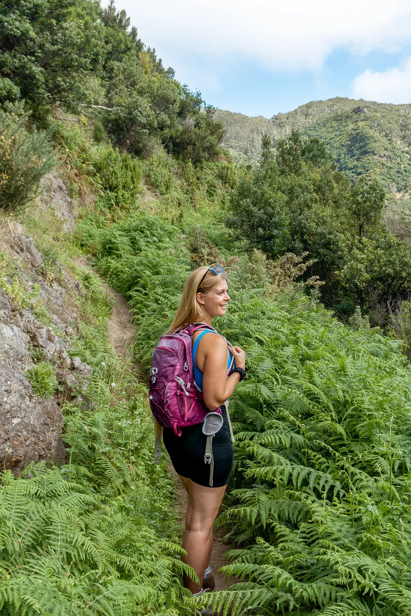
So facing the sign towards Boca do Risco and the coast, you take a right turn and hike in and up on the trail through the ferns. You’re basically just hiking along the coast but east towards Canical.
The first bit is probably the most challenging because you hike inland a little bit with quite a bit of elevation to get back around the coast.
Make sure to follow the trail and look at the trail map every now and then as there won’t be much more signage from here. There’s one little section in the forest where there are multiple trails and we ended up actually taking the wrong trail and going more inland.
Make sure to keep going along the coastal trail to stay on Boca do Risco. Use this trail map for the Boca do Risco Trail and you should be all good.
Once you’re out of the forest and along the coast again, the trail will be easy to follow pretty much until the end.
Continue along the Boca do Risco trail
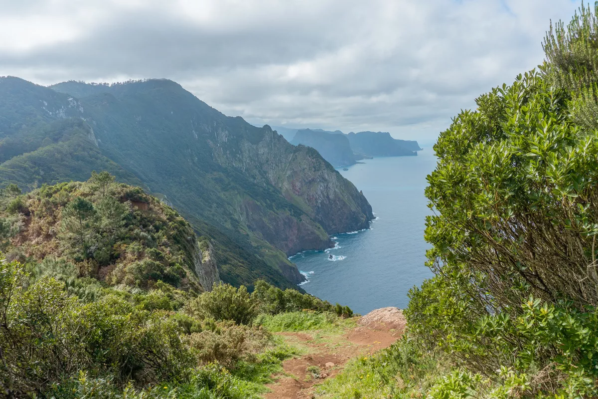
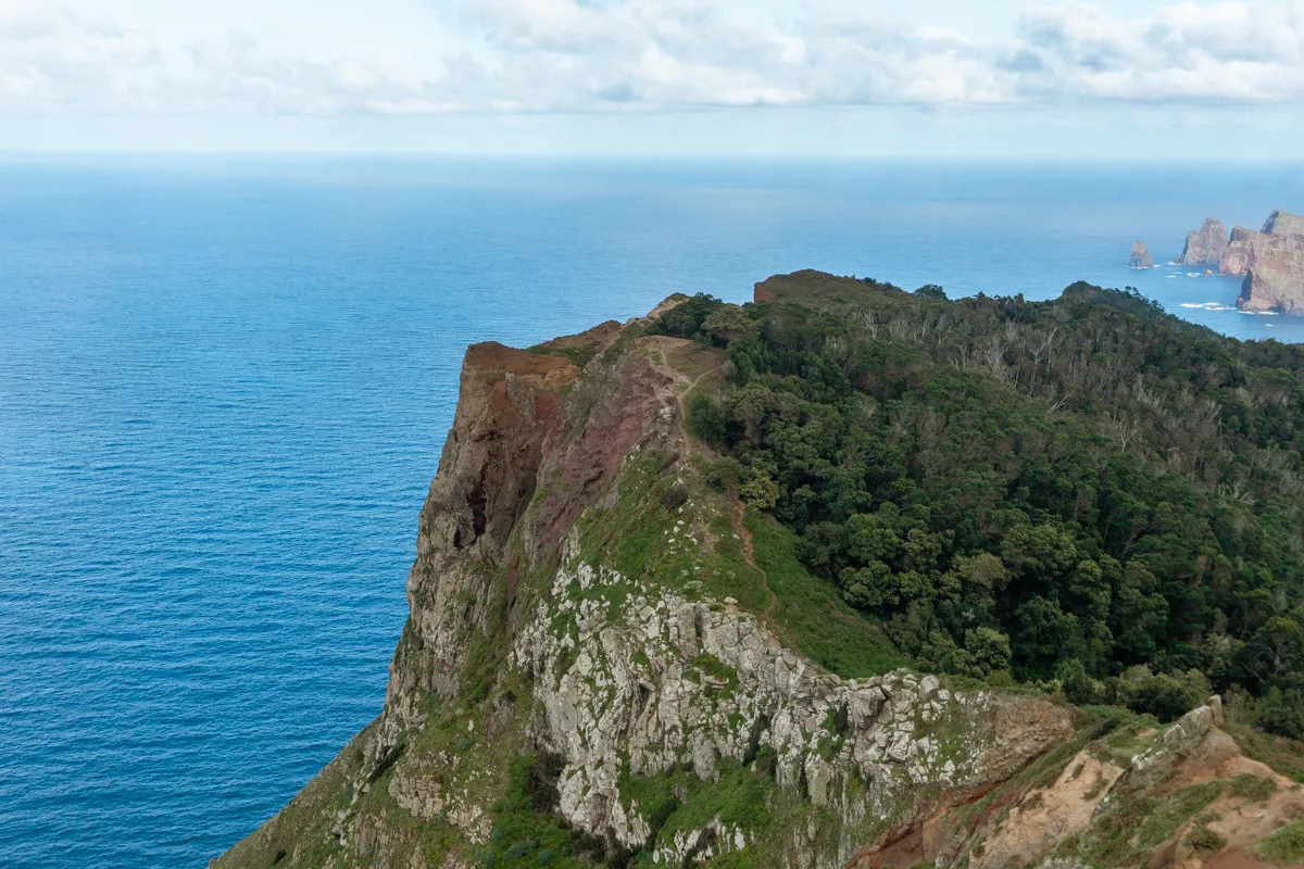
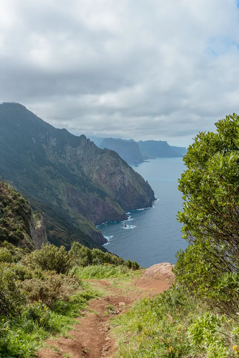
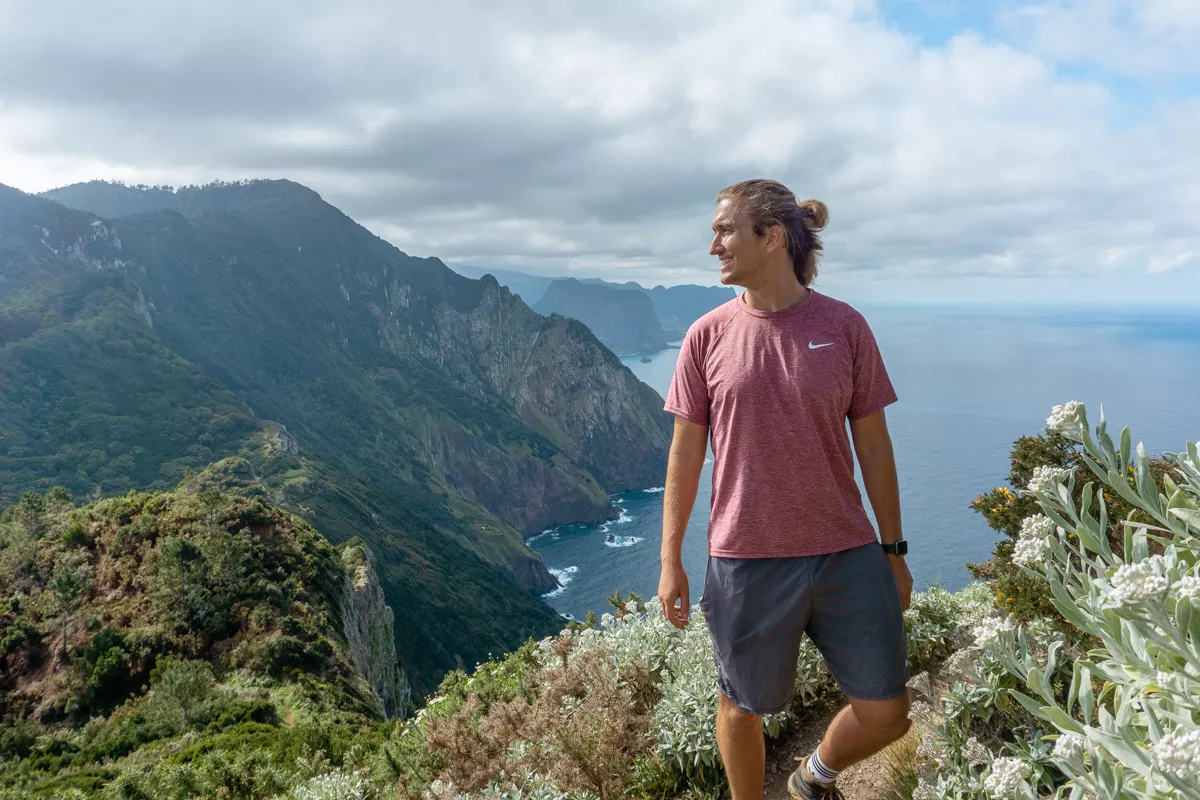
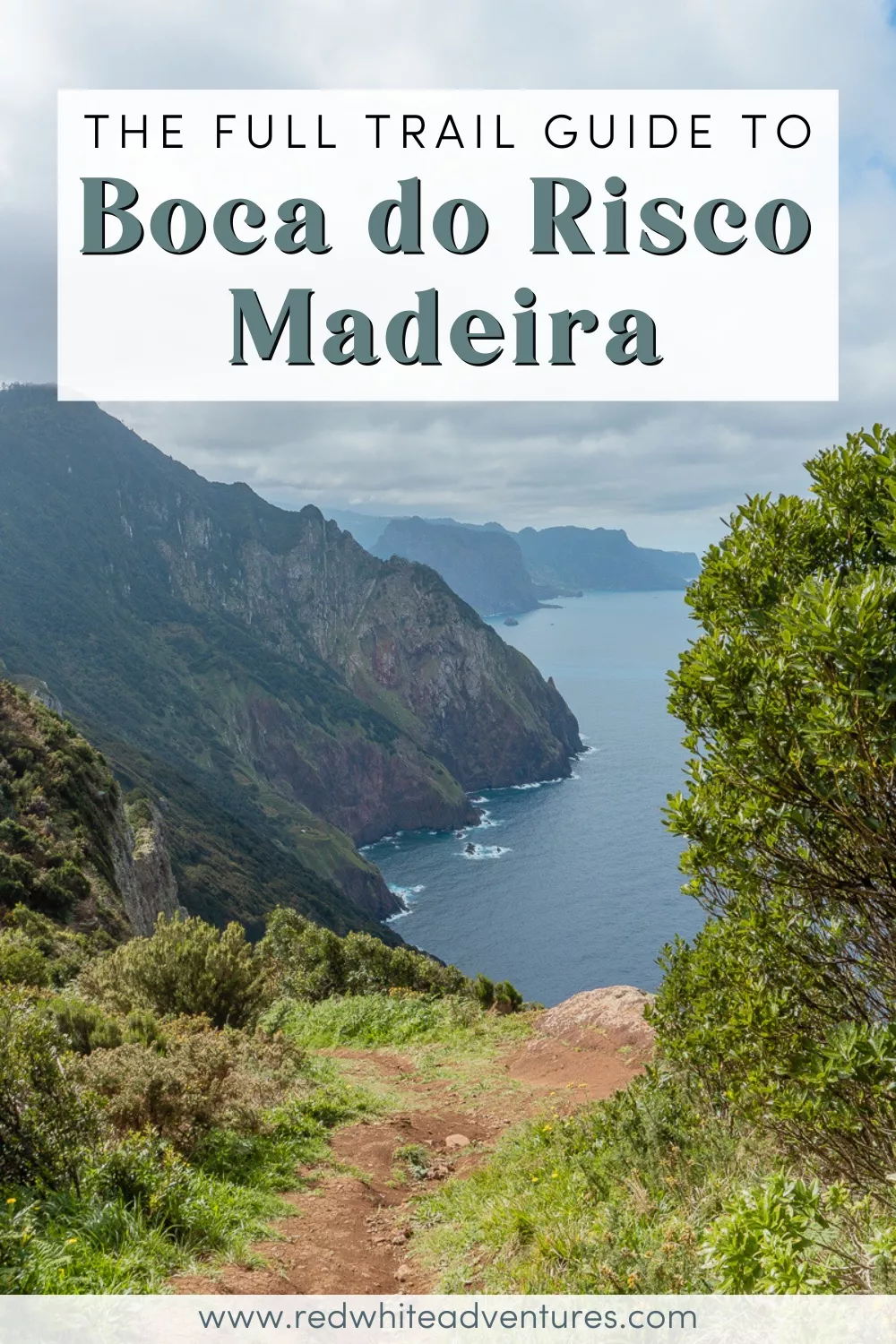
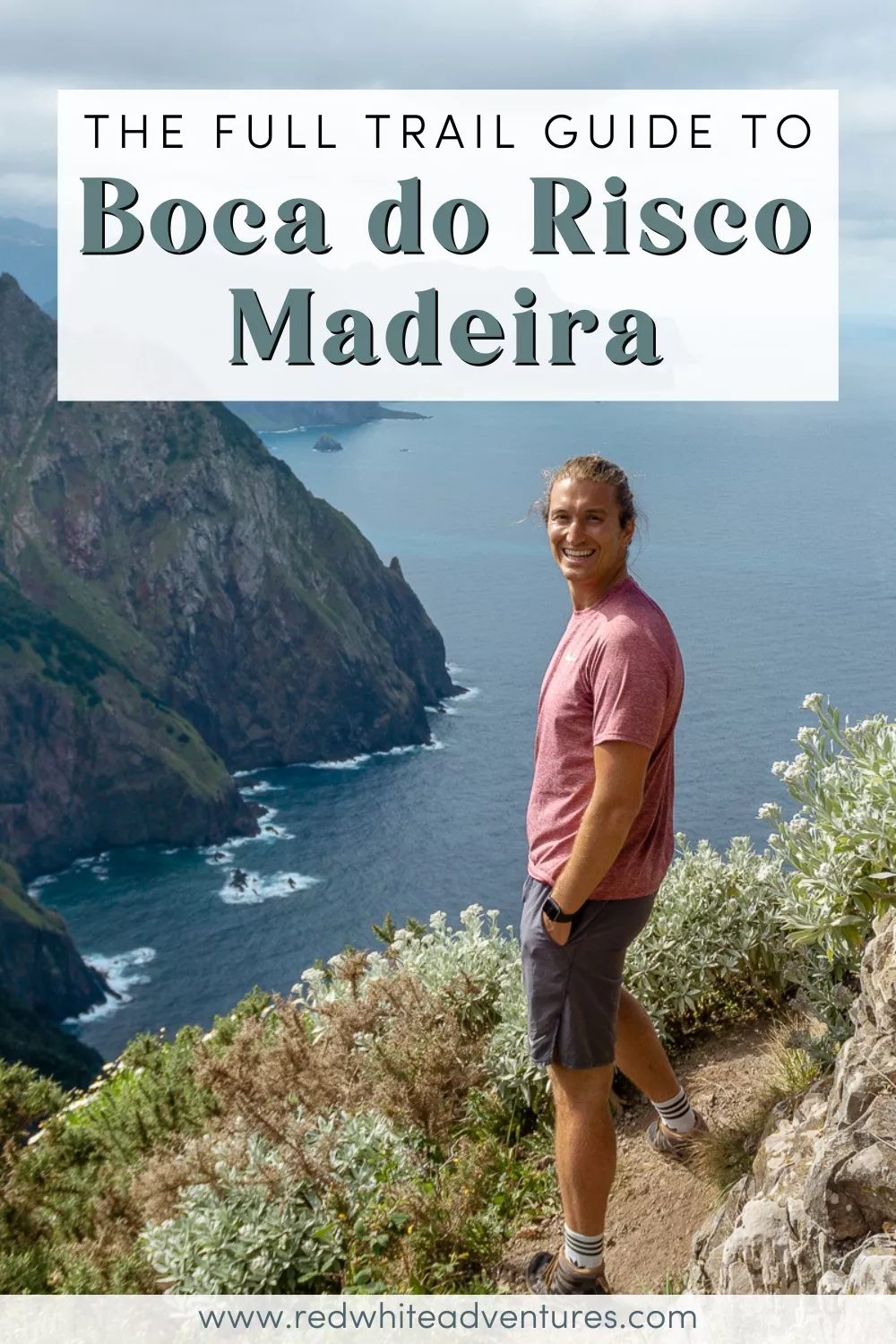
Now the real fun starts! Levada do Caniçal and the small section along Vereda do Larano are beautiful. But once you start on the Boca do Risco trail and get out of the trees towards the coast the views really come to life and they are insane!
One of the coolest parts about this trail is that you’re quite high up along the coast so you really get some amazing aerial views of the coast.
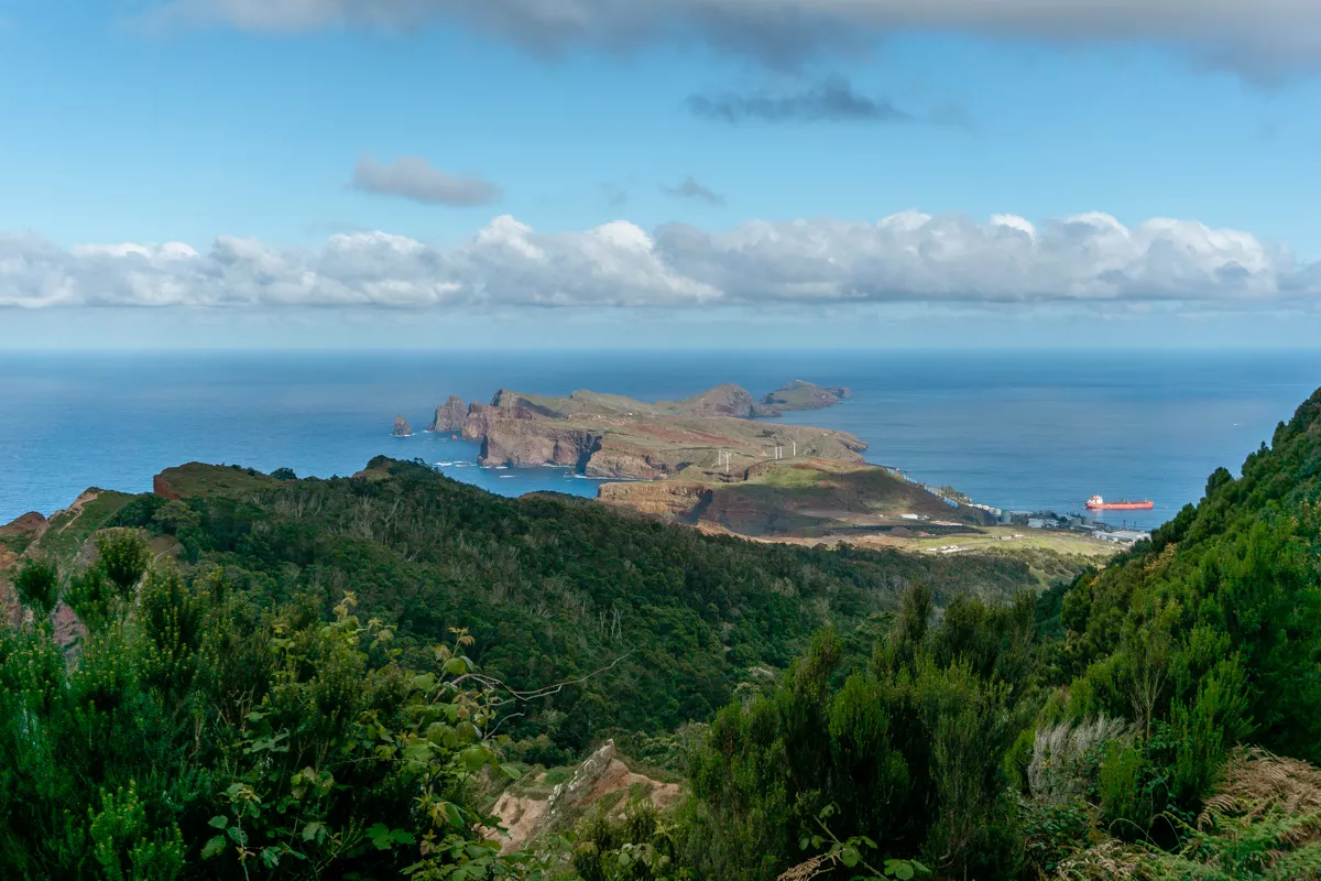
One of the main reasons we recommend doing the hike this way is because of the views that come once you’re on the trail hiking towards Caniçal.
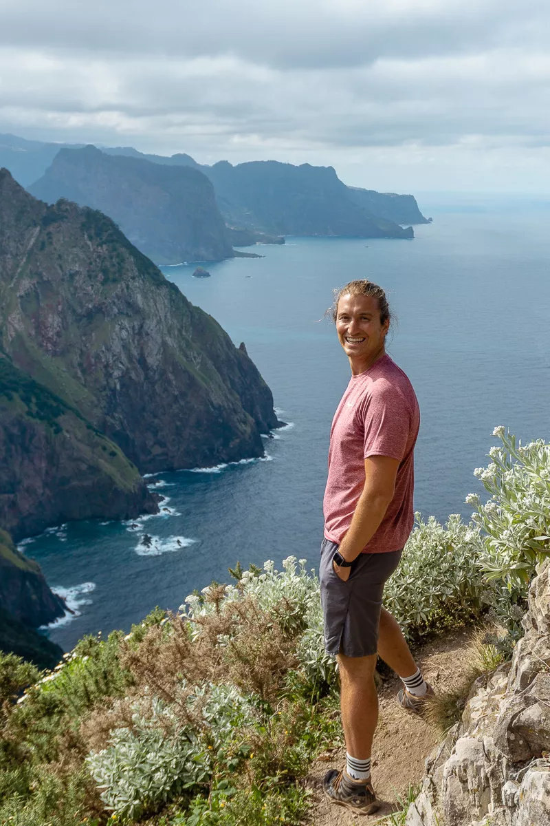
You start to see the “Dragon’s Tail” aka Ponta de Sao Lourenço come into view and it’s epic. From up here you can see why it’s called the Dragon’s Tail.
As you get closer and closer, the views really start to change and it’s so cool! You’ll (hopefully) see why we recommend doing the hike in this direction.
Soon enough, Caniçal will come into view and the hike is close to being done.
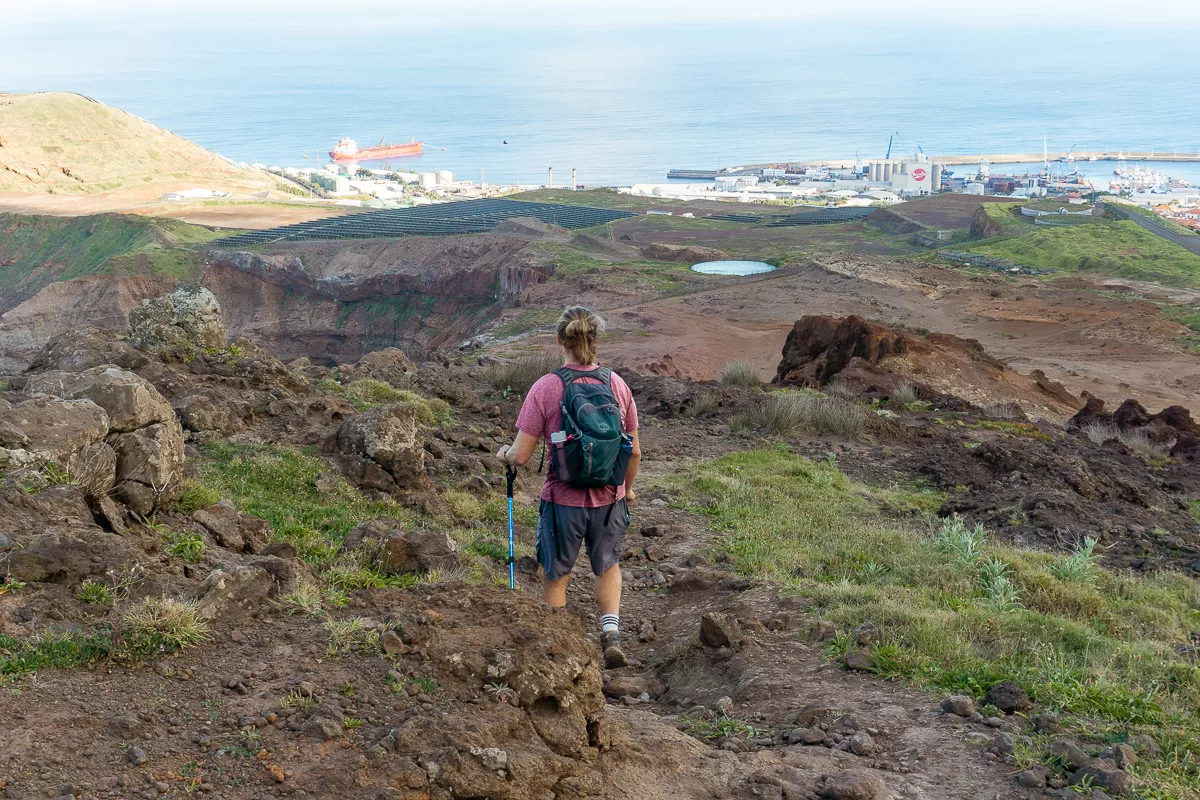
The last stretch to the end of Boca do Risco
If you think the hike gets better and better then just wait till the last part… The scenery and landscape slightly change as you leave the lush green nature behind. All of a sudden you end up in the middle of this very red volcanic-looking surface and it looks so cool.
The reason for this red-looking surface is that Madeira is a Volcanic island, which was created through a “hot spot” millions of years ago. However, the last volcanic eruption was “only” 6850 years ago.
The huge time span between all the volcanic events explains the drastic change in the landscape around the island.
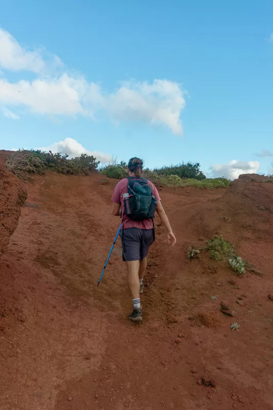
There isn’t really a trail to follow on this last stretch as it’s all just open. But you’ll see a parking lot in the distance and the goal is to get down to the bottom where the trail ends by that parking lot.
There are some sections that are visibly walked on more than others but it’s quite easy to find a way down.
Take your time though as it is a little steep and there are plenty of loose rocks and dirt all over the place. Steer away from the coast and you’ll be safe.
The last thing you want to do is roll an ankle or injure yourself right before the end of the hike. Not far from the end, you’ll see a road and the parking lot and that’s basically where the Boca do Risco hike ends.
There may be a bunch of cars parked because there is a popular viewpoint on the coast here where a lot of people come to enjoy the view overlooking Ponta de Sao Lourenço!
It is a beautiful view but to be honest, the views you’ve just seen on the hike are just as good if not better. There’s no need to go out to the viewpoints as well unless you really want to!
Make your way down to Caniçal
Once you finish Boca do Risco you’re done with the hike but you’re not done walking. You still need to get down to Canical to catch the bus back to Funchal or back to the starting point of the hike if you end up driving there.
We got quite lucky and the first person who drove by actually picked us up and drove us to Canical (a 3-minute drive). If you’re comfortable with hitchhiking there’s a good chance someone will drive you down.
Otherwise, you can just walk down to Canical. Thankfully it’s all downhill so it shouldn’t be too hard or take too long.
We ended up hitchhiking and going to Deus do Sol Cafe right in Canical where we waited for the bus. It’s quite convenient because the bus leaves directly from in front of the cafe. You can sit outside, enjoy a coffee, and wait for the bus to come.
This bus will take you directly to Funchal (or to Machico where you’ll do a quick bus swap and get on another bus that’s waiting to take people to Funchal. If this is the case, the driver will help you once you get to Machico).
What to bring on the Boca do Risco hike
Boca do Risco is a proper hike and not just an easy levada trail so you want to come prepared for this one. The hike does start on a levada but quickly makes its way up and into nature where it’s a more rough terrain!
Come prepared with proper hiking shoes, plenty of water, and some snacks to enjoy as you make your way around the coast!
You’re going to be quite exposed to the elements since you’re out along the coast. So on a sunny day, be prepared to get roasted by the sun as there isn’t much shade. It also gets quite windy by the coast so be prepared for that.
Check the weather beforehand and plan accordingly. Fill your bag up with goodies so you don’t get hungry along the way since it is quite a long hike.
You can see the weather for the Canical area here. This will also help give you an idea of what to pack for Boca do Risco.
Packing list for Boca do Risco:
- Water! We always fill up our LifeStraw bottles for hikes. Boca do Risco is quite a long hike so bring enough water for the 8kms!
- Sunscreen is highly recommended when hiking on Madeira. You’ll be quite exposed for most of the hike. There is only a small section where you’re covered by trees and the rest of the hike is out in the sun.
- A power bank is always nice to bring. Especially when you’re in a place you’re not completely familiar with. You’ll want some battery on your phone to check the bus schedules after the hike.
- It’s highly recommended to bring hiking poles on this hike! There is some solid incline and decline and the section towards the end has a lot of loose dirt so bringing hiking poles will come in pretty handy there.
- Wear proper hiking shoes on this one. Dom wears his Columbias on all hikes in Madeira. They’re also easier to clean after a day of hiking than runners or casual shoes.
You can also check out this great list of hiking gear to get some more inspiration for what you may need to bring!
Before you hike Levada do Cortado Coastal Trail
Check the weather
No matter where you hike, you should always check the weather for that specific area beforehand.
Madeira has a micro-climate so the weather is constantly changing around the island and can be very different even from Funchal to Machico and Caniçal.
You can check the weather for the Caniçal area here.
This will give you a good idea of the weather on that specific side of the island.
As we mentioned, on this hike you are quite exposed to the elements. You only have a very short section of forest and the rest is out in the open where you’re fully exposed to the sun. If it’s raining, then this hike isn’t worth doing.
On a clear sunny day, you can see the whole coastline, Porto Santo, Ponta de São Lourenço, the Atlantic Ocean, and all the stunning landscape around. We love walking along the coast and just taking in the views while the sun is beaming down on us!
If the weather’s not great along the east coast between Canical and Porta da Cruz then you can always try the other side of the island. Levada do Alecrim or PR6 Levada 25 Fontes are two solid options for hikes to do where the weather might be better.
Wear hiking shoes
We recommend hiking shoes for most hikes in Madeira and this is definitely one you want proper hiking boots for.
Once you get on Vereda do Larano and make your way to Boca do Risco the trail gets steep and slippery and the right footwear makes a world of a difference.
We take our Columbias everywhere even if it’s just on a simple trail. It’s nice having proper hiking shoes that you don’t mind getting a little dirty and muddy. They also do wonders in protecting our ankles.
So for this one, hiking boots are a priority.
Load the trail map
We usually load the trail map on our phone or take a picture of it so we have an idea of where to go in case we get lost (which we did on this one!).
Once you’re on the trail you should have a pretty good idea of where you’re going if you’ve studied the trail map beforehand and follow the signs as you go.
But just to be on the safe side, you might want to load the trail map beforehand! There is cell reception on a good chunk of the hike but you will find that on some sections, you’ll be without cellular data.
Leave no trace
When you go hiking (and do other outdoor adventure activities), always remember to follow the 7 principles of leaving no trace.
This means:
- Plan ahead and prepare
- Travel and camp on durable surfaces
- Dispose of waste properly
- Leave what you find
- Minimize campfire impacts
- Respect wildlife
- Be considerate of others
How to get to the start of the hike

Since this is a one-way trail (starts and finishes at different points) it’s actually best to get to this hike by bus. If you have a car then it may be best to make this hike a little longer and hike in and out and come back to the same spot you started.
But in our opinion, it’s best to take a bus to the start of the hike in Machico. Then take the bus back from Caniçal where the hike ends. The east side of the island is very easy to around by bus.
Remember, we’re not starting this hike at the Boca do Risco trailhead but instead at the Levada do Caniçal/Vereda do Larano trailhead. The starting point is right before the tunnel that leads to Caniçal.
The nice thing is that bus 113 stops directly at the trailhead and this is one of the reasons we recommend doing the hike the way that we do in this post.
If you do decide to rent a car in Madeira, you can park near the trailhead and then you will have to find your way back to the starting point again after the hike (which will make the trail pretty long).
Alternatively, you can drive to the trailhead in Caniçal and skip out on the levada section of the trail and only do the coastal part.
Again, we highly recommend doing it from Machico to Caniçal instead of the other way around. It’s easier to navigate, and the most beautiful way to do the hike in our opinion!
Taking the bus from Funchal to the trailhead
To get from Funchal to Vereda do Larano by bus, you can see the bus schedule for bus 113 here. There are multiple bus stops that bus 113 leaves from in Funchal, but if you’re staying in Old Town Funchal, you can take it from this Sam bus stop.
From Funchal, there’s an express 113 bus and a standard 113 bus. If you take the standard 113 you can get off directly in front of the tunnel where the hike starts. This is simple but also takes longer (about an hour) and might get you slightly carsick if you get that easily. It is very scenic though.
If you end up taking the express 113 then you will have to transfer in Machico at the main bus station. This should be at no additional cost to you and the ride will be faster and more pleasant as you avoid all the mountain roads on the way to Machico.
You can take either option so it just depends on when you want to leave Funchal and which option you prefer.
You can tell the driver that you are getting off at “Tunnel Caniçal” or going to “Vereda do Larano” and they’ll know exactly what you mean.
For us, taking the bus was the most convenient and cheapest way to get to the starting point of the hike.
It’s one of those hikes on the island where you don’t need a car. So if you don’t plan on renting a car then this is a great hike to do.
Pro tip: The bus schedule varies depending on the day of the week, so make sure you’re looking at the right day.
Getting to Vereda do Larano by car
Here are the distances and time frames between Funchal and Vereda do Larano as well as Ponta do Sol to Vereda do Larano.
From Funchal to start of Vereda do Larano trail:
- 30-minute drive (30 kilometers)
- You can follow the directions from Funchal to Vereda do Larano here.
From Ponta do Sol to Vereda do Larano trail:
- 45-minute drive (50 kilometers)
- You can follow the directions from Ponta do Sol to Vereda do Larano here.
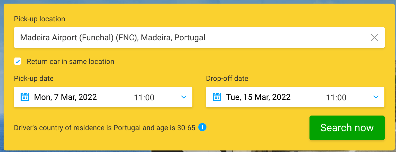
Renting a car in Madeira
For this specific hike in Madeira, renting a car can work but it can also be a bit challenging. You will either need to hike back and do the full-way return or take a bus, taxi, or Bolt back to the starting point to pick up your car again next to Vereda do Larano.
There are multiple car rentals in Funchal so the easiest way to get the best price is by checking DiscoverCars. There are multiple car rental companies and pick-up locations in the city so it’s super convenient.
Just check what the pickup location is before hitting that booking button to ensure it’s close to your accommodation!
You can look at the prices and different cars on DiscoverCars to see the different options across the different car rental providers.
Driving in Madeira is actually quite fun and super easy. There’s lots of cool places you can’t get to by public transport and having a car makes a world of a difference!

How to get back to Funchal from the end of the hike
The reason we recommend taking public transport if you’re staying in Funchal is that once you’re done with the hike, you can just hop on the bus from Caniçal and go directly to Funchal from there.
This public transport map for Madeira will become super useful over your time in Madeira. It has all the routes on the eastern side of the island including timetables. So you can always screenshot these in case you run out of data or don’t have reception.
You can stop at Deus do Sol Cafe and wait for the bus in Canical. The bus stop is right in front of the cafe so you can sit outside and enjoy a coffee until the bus comes.
If you can’t find a bus stop, ask any local “SAM Autobus Funchal” and they’ll point you in the right direction. The locals in Madeira are always so friendly and helpful!
The bus from Canical stops in Machico before making its way back to Funchal. Depending on which bus you’re on you may have to swap buses in Machico at no extra cost. You’ll see once you’re in Machico if everyone gets off the bus or not – and the bus driver will help you too if this is the case.
Note: Remember not to throw away your bus ticket because you will have to show it on the next bus if you end up swapping buses!
Best time to hike the Boca do Risco Trail
One thing we love about Boca do Risco is that it is more of a less known hike compared to some of the other hikes we’ve done on the island.
At pretty much any time of the day, the trail will rarely be full of people. But because of the daylight, it might be nice to do the hike later in the day so you have the sun behind you and not right in your face.
You’ll still have sunshine if you hike Boca do Risco in the afternoon but it won’t be shining right in your face.
We did the hike between 12 pm – 5 pm and it was really nice. Also, we only ran into 2-3 other people on the Boca do Risco section of the hike.
Make sure to plan this hike on a nice and sunny day. If the weather doesn’t look great around Caniçal then it might be better to go to another part of the island.
Since there are so many micro-climates around Madeira you’ll find another area where the sun is shining!
You may also like…
- Best View in Ribeiro Frio: Hiking PR11 Vereda dos Balcões
- Exploring the Beautiful Aguage Waterfall in Santana, Madeira
- Discover the Wonders of Madeira on a Private Jeep Tour
- Hiking Levada dos Tornos to Monte in Funchal – Full Guide
- 5 Beautiful Hotel to Stay at in Santana, Madeira
Recap of hiking the Boca do Risco coastal trail
This is one of the coastal trails we love the most on the east side of the island! From Porto da Cruz all the way to Caniçal, the coastline is just amazing.
You have Boca do Risco, Vereda do Larano, and Levada do Cortado which all showcase the beauty of this coast.
If you get a chance to explore the eastern part of Madeira, the coasts are some of our favourite places to hike. They’re usually less busy than the famous hikes like PR1 Pico Arieiro and Levada 25 Fontes and equally as beautiful but in their own unique way.
One of the best parts of Boca do Risco is the view you get of Ponta de Sao Lourenço as you hike down. Seeing Madeira’s most eastern point from above is something special and one of our favourite views on the island (I swear we say that for every view, haha).
If you have any questions about the hike or other things to do on Madeira then feel free to DM us on Instagram @redwhiteadventures or leave a comment below!
We love sharing awesome things to do in Madeira and off-the-beaten-path hikes like Boca do Risco and are always happy to help.
Enjoy this amazing coastal hike in Madeira. We hope you have an awesome time exploring the island!
Enjoyed this post? Pin & save it for later!


Thank you for writing such a descriptive post – it helped tremendously when doing the trek. And fantastic recommendation; loved it!!
Hey Lauren,
Thanks for the awesome feedback and glad you got to enjoy the trail. It’s one of our favourite hikes on the island.
-Jo